Resende night lights from space
Night Light of Resende (Rio de Janeiro) from space (Brazil) Src. Average luminocity for 10x10km area is 39.9848% and for 50x50km: 7.0202%.
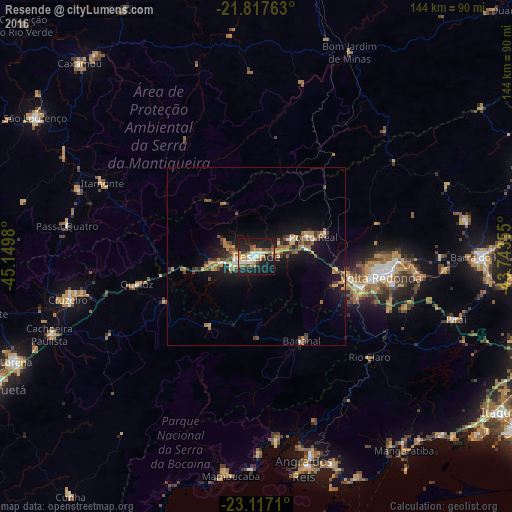
Analysis of Resende night lights 2016
Square area 10x10 km:
 4.36%
4.36%90-99
8.52%80-89
3.98%70-79
6.25%60-69
5.68%50-59
6.06%40-49
3.6%30-39
2.84%20-29
14.02%10-19
41.48%0-9
3.22%Square area 50x50 km:
0.42%90-99
0.73%80-89
0.64%70-79
1.32%60-69
1.18%50-59
1.12%40-49
1.09%30-39
1.11%20-29
1.58%10-19
7.36%0-9
83.46%Clear (daylight) street map image can be seen on geolist.org.
Map coordinates:
21° 49' 3.5" South, 45° 8' 59.3" West
22° 28' 8" South, 44° 26' 48" West
23° 7' 1.6" South, 43° 44' 36.8" West
Some cities around Resende sort by population:
• Volta Redonda
35.7 km =22.2 mi,  99°
99°
• Barra Mansa
29.5 km =18.3 mi,  106°
106°
• Pinheiral
46.1 km =28.6 mi, 96°
• Rio Claro
42.6 km =26.5 mi,  131°
131°
• Itatiaia
12.4 km =7.7 mi,  255°
255°
• Porto Real
17 km =10.6 mi,  71°
71°
• Itanhandu
53.7 km =33.4 mi,  290°
290°
• Quatis
20.6 km =12.8 mi, 70°
3451668 (p: 111,514)
Sources (retrieved 2019-11-25):
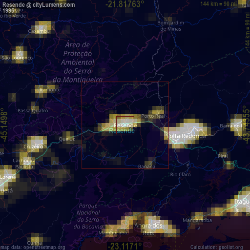
» NASA, Earths city lights 1995
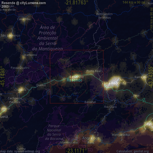
» NASA city lights 2003
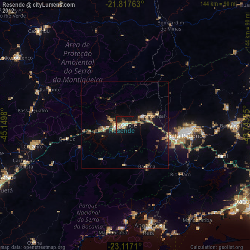
» Earth at Night: Flat Maps 2012, 2016