Porto da Folha night lights from space
Night Light of Porto da Folha (Sergipe) from space (Brazil) Src. Average luminocity for 10x10km area is 20.7128% and for 50x50km: 3.755%.
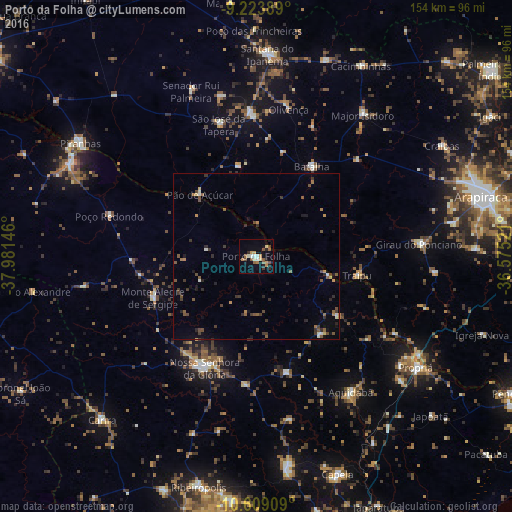
Analysis of Porto da Folha night lights 2016
Square area 10x10 km:
 1.45%
1.45%90-99
3.51%80-89
1.65%70-79
3.72%60-69
3.1%50-59
5.58%40-49
1.65%30-39
1.24%20-29
4.13%10-19
8.47%0-9
65.5%Square area 50x50 km:
0.12%90-99
0.42%80-89
0.2%70-79
0.35%60-69
0.5%50-59
1.04%40-49
0.72%30-39
1.03%20-29
0.93%10-19
1.25%0-9
93.46%Clear (daylight) street map image can be seen on geolist.org.
Map coordinates:
9° 13' 26" South, 37° 58' 53.3" West
9° 55' 2" South, 37° 16' 42" West
10° 36' 32.7" South, 36° 34' 30.8" West
Some cities around Porto da Folha sort by population:
• Nossa Senhora da Glória
36.9 km =22.9 mi,  204°
204°
• São José da Tapera
41.5 km =25.8 mi,  344°
344°
• Batalha
31.5 km =19.6 mi,  32°
32°
• Pão de Açúcar
25.6 km =15.9 mi,  317°
317°
• Aquidabã
49.5 km =30.8 mi,  144°
144°
• Girau do Ponciano
49.4 km =30.7 mi,  85°
85°
• Traipu
30.7 km =19.1 mi,  101°
101°
• Monte Alegre de Sergipe
33.4 km =20.8 mi,  248°
248°
3391395 (p: 9,420)
Sources (retrieved 2019-11-25):
» Earth at Night: Flat Maps 2012, 2016