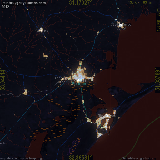
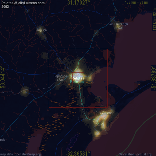
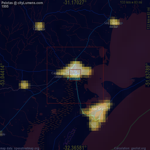
Pelotas night lights from space
Night Light of Pelotas (Rio Grande do Sul) from space (Brazil) Src. Average luminocity for 10x10km area is 59.9689% and for 50x50km: 6.64%.

Analysis of Pelotas night lights 2016
Square area 10x10 km:
 18.5%
18.5%90-99
19.23%80-89
6.59%70-79
4.4%60-69
4.21%50-59
3.48%40-49
2.93%30-39
2.38%20-29
17.95%10-19
19.23%0-9
1.1%Square area 50x50 km:
0.94%90-99
1.11%80-89
0.94%70-79
0.62%60-69
0.77%50-59
0.98%40-49
0.77%30-39
0.88%20-29
2.34%10-19
4.31%0-9
86.35%Clear (daylight) street map image can be seen on geolist.org.
Map coordinates:
31° 10' 13" South, 53° 2' 38.9" West
31° 46' 11.9" South, 52° 20' 27.6" West
32° 21' 56.9" South, 51° 38' 16.4" West
Some cities around Pelotas sort by population:
• Rio Grande
37.3 km =23.2 mi,  142°
142°
• Camaquã
113.8 km =70.7 mi,  26°
26°
• Jaguarão
131.6 km =81.8 mi,  227°
227°
• São Lourenço do Sul
56.6 km =35.2 mi,  37°
37°
• Canguçu
52.4 km =32.6 mi,  322°
322°
• Herval
103.5 km =64.3 mi,  254°
254°
• Arroio Grande
87.5 km =54.4 mi, 233°
• Pinheiro Machado
100.7 km =62.6 mi,  282°
282°
3454244 (p: 320,674)
Sources (retrieved 2019-11-25):
» NASA, Earths city lights 1995
» NASA city lights 2003
» Earth at Night: Flat Maps 2012, 2016