Jaguariúna night lights from space
Night Light of Jaguariúna (São Paulo) from space (Brazil) Src. Average luminocity for 10x10km area is 56.7004% and for 50x50km: 35.8237%.
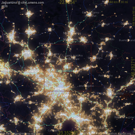
Analysis of Jaguariúna night lights 2016
Square area 10x10 km:
 7.34%
7.34%90-99
8.53%80-89
5.16%70-79
10.12%60-69
11.11%50-59
9.72%40-49
18.45%30-39
15.08%20-29
14.48%10-19
0%0-9
0%Square area 50x50 km:
5.61%90-99
5.61%80-89
5.57%70-79
7.97%60-69
5.31%50-59
3.83%40-49
4.33%30-39
4.99%20-29
8.2%10-19
14.07%0-9
34.52%Clear (daylight) street map image can be seen on geolist.org.
Map coordinates:
22° 3' 19.4" South, 47° 41' 20.3" West
22° 42' 20" South, 46° 59' 9" West
23° 21' 9.5" South, 46° 16' 57.8" West
Some cities around Jaguariúna sort by population:
• Campinas
23.5 km =14.6 mi,  199°
199°
• Hortolândia
29.4 km =18.3 mi,  234°
234°
• Paulínia
18.3 km =11.4 mi,  250°
250°
• Cosmópolis
22.6 km =14 mi,  287°
287°
• Amparo
22.7 km =14.1 mi,  88°
88°
• Artur Nogueira
24.2 km =15 mi,  307°
307°
• Pedreira
9.6 km =6 mi,  115°
115°
• Santo Antônio de Posse
13 km =8.1 mi,  31°
31°
3460200 (p: 31,717)
Sources (retrieved 2019-11-25):
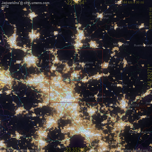
» Earth at Night: Flat Maps 2012, 2016