Petrópolis night lights from space
Night Light of Petrópolis (Rio de Janeiro) from space (Brazil) Src. Average luminocity for 10x10km area is 58.483% and for 50x50km: 30.5327%.
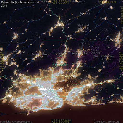
Analysis of Petrópolis night lights 2016
Square area 10x10 km:
 3.22%
3.22%90-99
3.98%80-89
13.83%70-79
18.56%60-69
17.99%50-59
9.09%40-49
3.22%30-39
7.95%20-29
16.48%10-19
5.68%0-9
0%Square area 50x50 km:
3.42%90-99
3.98%80-89
2.89%70-79
6.7%60-69
7.66%50-59
5.13%40-49
4.18%30-39
4.62%20-29
6.86%10-19
14.86%0-9
39.7%Clear (daylight) street map image can be seen on geolist.org.
Map coordinates:
21° 51' 14.1" South, 43° 52' 54.3" West
22° 30' 18" South, 43° 10' 43" West
23° 9' 10.9" South, 42° 28' 31.8" West
Some cities around Petrópolis sort by population:
• Duque de Caxias
34.1 km =21.2 mi,  203°
203°
• Belford Roxo
36.7 km =22.8 mi,  218°
218°
• Teresópolis
22.8 km =14.2 mi,  64°
64°
• Guapimirim
20.5 km =12.7 mi,  100°
100°
• Miguel Pereira
30.4 km =18.9 mi,  280°
280°
• Paty do Alferes
26.1 km =16.2 mi,  289°
289°
• São Pedro
23.7 km =14.7 mi,  67°
67°
• Areal
31.4 km =19.5 mi,  13°
13°
3454031 (p: 272,691)
Sources (retrieved 2019-11-25):
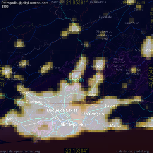
» NASA, Earths city lights 1995
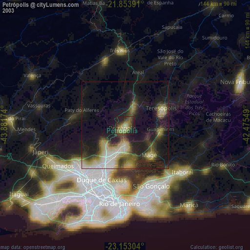
» NASA city lights 2003
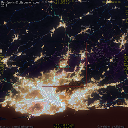
» Earth at Night: Flat Maps 2012, 2016