Palhoça night lights from space
Night Light of Palhoça (Santa Catarina) from space (Brazil) Src. Average luminocity for 10x10km area is 77.5873% and for 50x50km: 24.3328%.
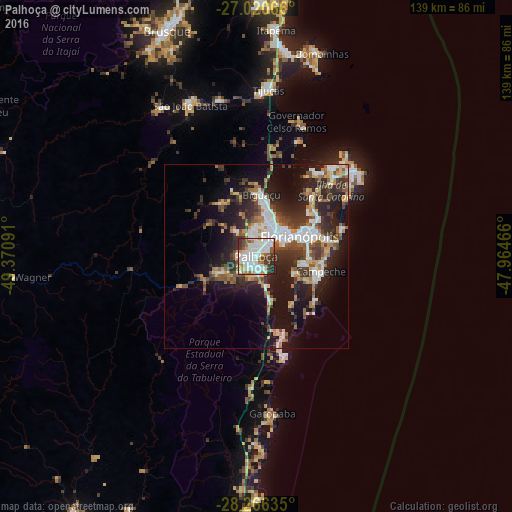
Analysis of Palhoça night lights 2016
Square area 10x10 km:
 29.56%
90-99
24.01%80-89
3.57%70-79
6.15%60-69
7.34%50-59
8.13%40-49
7.54%30-39
9.52%20-29
4.17%10-19
0%0-9
0%Square area 50x50 km:
4.49%90-99
4.6%80-89
2.12%70-79
2.44%60-69
2.7%50-59
3.49%40-49
3.6%30-39
4.67%20-29
8.25%10-19
14.58%0-9
49.07%Clear (daylight) street map image can be seen on geolist.org.
Map coordinates:
27° 1' 14.4" South, 49° 22' 15.3" West
27° 38' 43" South, 48° 40' 4" West
28° 15' 58.9" South, 47° 57' 52.8" West
Some cities around Palhoça sort by population:
• Florianópolis
12.9 km =8 mi,  65°
65°
• Ribeirão da Ilha
14.6 km =9.1 mi,  114°
114°
• Freguesia do Ribeirao da Ilha
13.1 km =8.1 mi,  127°
127°
• Campinas
8.2 km =5.1 mi,  46°
46°
• Santo Amaro da Imperatriz
11.9 km =7.4 mi,  246°
246°
• Trindade
15.7 km =9.8 mi, 65°
• Saco dos Limoes
13.6 km =8.5 mi, 72°
• Costeira do Pirajubae
14.5 km =9 mi,  85°
85°
3455478 (p: 122,423)
Sources (retrieved 2019-11-25):
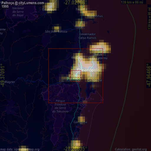
» NASA, Earths city lights 1995
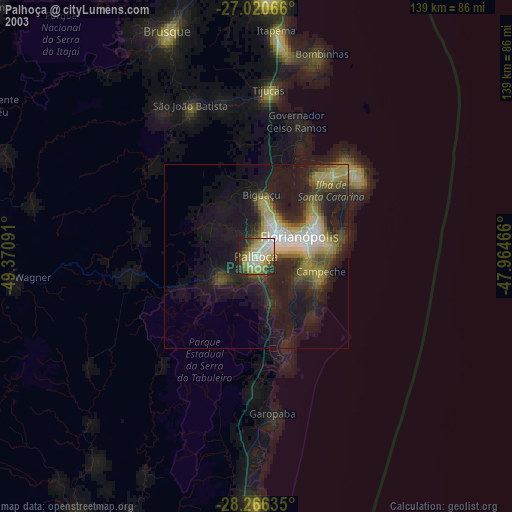
» NASA city lights 2003
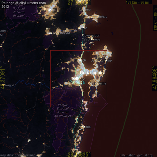
» Earth at Night: Flat Maps 2012, 2016