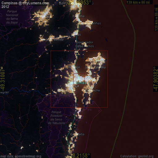
Campinas night lights from space
Night Light of Campinas (Santa Catarina) from space (Brazil) Src. Average luminocity for 10x10km area is 77.756% and for 50x50km: 25.8944%.

Analysis of Campinas night lights 2016
Square area 10x10 km:
 32.14%
90-99
25%80-89
1.59%70-79
4.37%60-69
3.17%50-59
8.33%40-49
13.49%30-39
11.31%20-29
0.6%10-19
0%0-9
0%Square area 50x50 km:
4.67%90-99
4.83%80-89
2.27%70-79
2.52%60-69
2.82%50-59
3.76%40-49
3.78%30-39
4.72%20-29
8.97%10-19
16.13%0-9
45.53%Clear (daylight) street map image can be seen on geolist.org.
Map coordinates:
26° 58' 10.3" South, 49° 18' 36.3" West
27° 35' 40" South, 48° 36' 25" West
28° 12' 56.9" South, 47° 54' 13.8" West
Some cities around Campinas sort by population:
• Florianópolis
5.7 km =3.5 mi,  92°
92°
• Palhoça
8.2 km =5.1 mi,  226°
226°
• Biguaçu
12.1 km =7.5 mi,  336°
336°
• Trindade
8.3 km =5.2 mi,  83°
83°
• Saco dos Limoes
7.2 km =4.5 mi,  102°
102°
• Itacorubi
11.1 km =6.9 mi, 83°
• Costeira do Pirajubae
9.6 km =6 mi,  118°
118°
• Santa Monica
9.8 km =6.1 mi, 88°
6316729 (p: 20,000)
Sources (retrieved 2019-11-25):
» Earth at Night: Flat Maps 2012, 2016