Natal night lights from space
Night Light of Natal (Rio Grande do Norte) from space (Brazil) Src. Average luminocity for 10x10km area is 79.1963% and for 50x50km: 28.9207%.
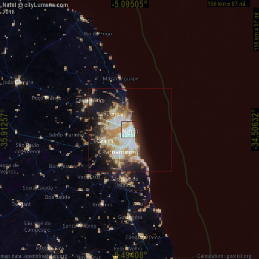
Analysis of Natal night lights 2016
Square area 10x10 km:
 32.64%
90-99
27.27%80-89
11.78%70-79
4.34%60-69
0%50-59
0.41%40-49
2.69%30-39
7.44%20-29
11.78%10-19
1.65%0-9
0%Square area 50x50 km:
4.57%90-99
6.91%80-89
4.75%70-79
3.16%60-69
4.43%50-59
3.79%40-49
3.46%30-39
2.73%20-29
6.22%10-19
12.53%0-9
47.45%Clear (daylight) street map image can be seen on geolist.org.
Map coordinates:
5° 5' 42.2" South, 35° 54' 45.3" West
5° 47' 42" South, 35° 12' 34" West
6° 29' 38.7" South, 34° 30' 22.8" West
Some cities around Natal sort by population:
• Parnamirim
14.6 km =9.1 mi,  203°
203°
• Macaíba
17.5 km =10.9 mi,  246°
246°
• Ceará Mirim
29.8 km =18.5 mi,  306°
306°
• Extremoz
14.7 km =9.1 mi, 312°
• São José de Mipibu
31.3 km =19.4 mi,  185°
185°
• São Miguel
40.4 km =25.1 mi,  334°
334°
• São Gonçalo do Amarante
13.3 km =8.3 mi,  270°
270°
• Nísia Floresta
32.9 km =20.4 mi,  179°
179°
3394023 (p: 763,043)
Sources (retrieved 2019-11-25):
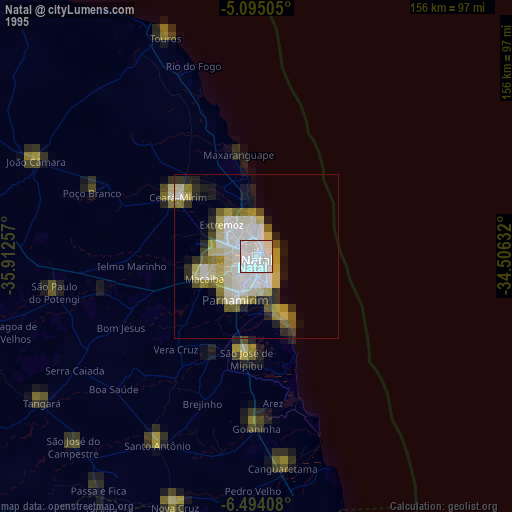
» NASA, Earths city lights 1995
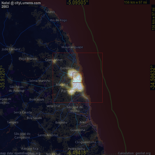
» NASA city lights 2003
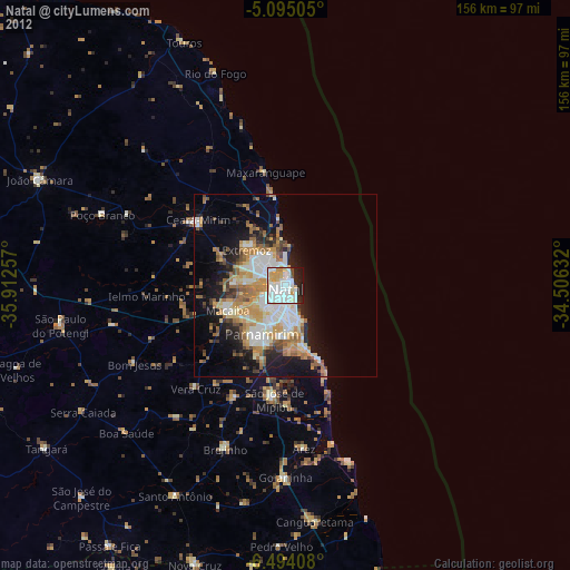
» Earth at Night: Flat Maps 2012, 2016