Macaíba night lights from space
Night Light of Macaíba (Rio Grande do Norte) from space (Brazil) Src. Average luminocity for 10x10km area is 56.7583% and for 50x50km: 32.0432%.
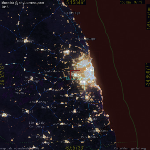
Analysis of Macaíba night lights 2016
Square area 10x10 km:
 2.07%
2.07%90-99
12.81%80-89
13.22%70-79
7.44%60-69
15.7%50-59
10.12%40-49
7.64%30-39
4.75%20-29
15.08%10-19
11.16%0-9
0%Square area 50x50 km:
4.54%90-99
7.06%80-89
5.21%70-79
3.68%60-69
4.92%50-59
5.04%40-49
3.9%30-39
3.64%20-29
6.99%10-19
13.73%0-9
41.29%Clear (daylight) street map image can be seen on geolist.org.
Map coordinates:
5° 9' 30.5" South, 36° 3' 25.3" West
5° 51' 30" South, 35° 21' 14" West
6° 33' 26.4" South, 34° 39' 2.8" West
Some cities around Macaíba sort by population:
• Natal
17.5 km =10.9 mi,  66°
66°
• Parnamirim
11.9 km =7.4 mi,  122°
122°
• Ceará Mirim
26.1 km =16.2 mi,  342°
342°
• Extremoz
17.8 km =11.1 mi,  16°
16°
• São José de Mipibu
27.3 km =17 mi,  151°
151°
• São Gonçalo do Amarante
7.7 km =4.8 mi, 20°
• Nísia Floresta
30.5 km =19 mi, 148°
• Brejinho
37 km =23 mi,  180°
180°
3396048 (p: 40,015)
Sources (retrieved 2019-11-25):
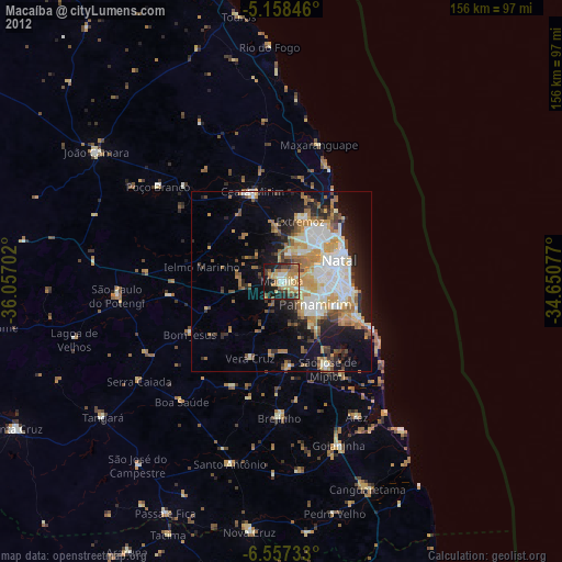
» Earth at Night: Flat Maps 2012, 2016