Macau night lights from space
Night Light of Macau (Rio Grande do Norte) from space (Brazil) Src. Average luminocity for 10x10km area is 20.5207% and for 50x50km: 3.1719%.
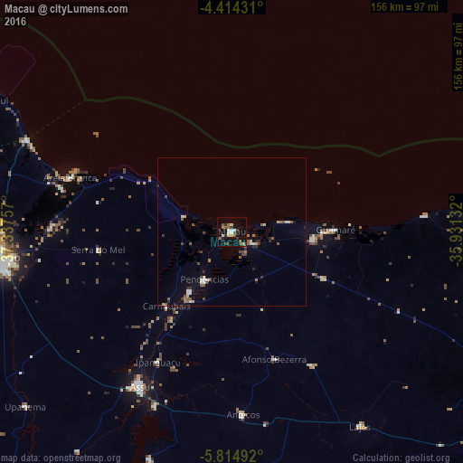
Analysis of Macau night lights 2016
Square area 10x10 km:
 1.03%
1.03%90-99
3.93%80-89
2.89%70-79
1.24%60-69
1.24%50-59
5.37%40-49
2.89%30-39
3.72%20-29
1.24%10-19
21.69%0-9
54.75%Square area 50x50 km:
0.07%90-99
0.67%80-89
0.24%70-79
0.29%60-69
0.33%50-59
0.83%40-49
0.36%30-39
0.51%20-29
0.51%10-19
1.26%0-9
94.93%Clear (daylight) street map image can be seen on geolist.org.
Map coordinates:
4° 24' 51.5" South, 37° 20' 15.3" West
5° 6' 54" South, 36° 38' 4" West
5° 48' 53.7" South, 35° 55' 52.8" West
Some cities around Macau sort by population:
• Mossoró
79 km =49.1 mi,  264°
264°
• Açu
59.6 km =37 mi,  210°
210°
• Areia Branca
58.4 km =36.3 mi,  287°
287°
• Pendências
18.8 km =11.7 mi, 211°
• Angicos
61.3 km =38.1 mi,  176°
176°
• Afonso Bezerra
44.9 km =27.9 mi,  161°
161°
• Upanema
90.5 km =56.2 mi,  229°
229°
• Monte Alegre
93.7 km =58.2 mi, 156°
3395998 (p: 18,070)
Sources (retrieved 2019-11-25):
» Earth at Night: Flat Maps 2012, 2016