Juatuba night lights from space
Night Light of Juatuba (Minas Gerais) from space (Brazil) Src. Average luminocity for 10x10km area is 36.7922% and for 50x50km: 25.4096%.
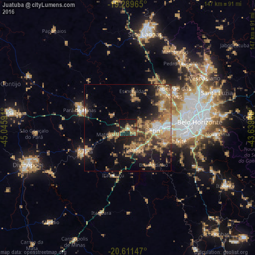
Analysis of Juatuba night lights 2016
Square area 10x10 km:
 0.22%
0.22%90-99
1.52%80-89
1.08%70-79
14.5%60-69
12.12%50-59
4.33%40-49
3.68%30-39
8.44%20-29
14.07%10-19
32.03%0-9
8.01%Square area 50x50 km:
2.04%90-99
2.02%80-89
1.73%70-79
8.06%60-69
6.05%50-59
3.29%40-49
4.82%30-39
4.05%20-29
5.55%10-19
13.54%0-9
48.84%Clear (daylight) street map image can be seen on geolist.org.
Map coordinates:
19° 17' 22.7" South, 45° 2' 45.3" West
19° 57' 7" South, 44° 20' 34" West
20° 36' 41.3" South, 43° 38' 22.8" West
Some cities around Juatuba sort by population:
• Betim
15.2 km =9.4 mi,  96°
96°
• Esmeraldas
21.3 km =13.2 mi,  8°
8°
• Itaúna
28 km =17.4 mi,  240°
240°
• Brumadinho
26 km =16.2 mi,  144°
144°
• Mateus Leme
9.7 km =6 mi,  246°
246°
• Igarapé
13.8 km =8.6 mi,  161°
161°
• Sarzedo
22.7 km =14.1 mi,  114°
114°
• São Joaquim de Bicas
13 km =8.1 mi,  146°
146°
3459550 (p: 24,537)
Sources (retrieved 2019-11-25):
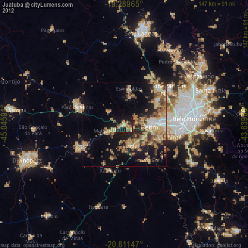
» Earth at Night: Flat Maps 2012, 2016