Jequié night lights from space
Night Light of Jequié (Bahia) from space (Brazil) Src. Average luminocity for 10x10km area is 57.7541% and for 50x50km: 3.3804%.
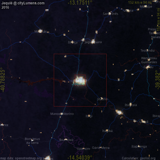

Analysis of Jequié night lights 2016
Square area 10x10 km:
 7.23%
7.23%90-99
23.55%80-89
8.47%70-79
6.82%60-69
2.69%50-59
6.2%40-49
5.79%30-39
5.17%20-29
14.26%10-19
19.63%0-9
0.21%Square area 50x50 km:
0.29%90-99
0.99%80-89
0.36%70-79
0.33%60-69
0.21%50-59
0.4%40-49
0.48%30-39
0.38%20-29
0.79%10-19
3.07%0-9
92.71%Clear (daylight) street map image can be seen on geolist.org.
Map coordinates:
13° 10' 30.4" South, 40° 47' 17.7" West
13° 51' 31.5" South, 40° 5' 6.4" West
14° 32' 25.4" South, 39° 22' 55.2" West
Some cities around Jequié sort by population:
• Jaguaquara
38.5 km =23.9 mi,  18°
18°
• Ipiaú
48.3 km =30 mi,  129°
129°
• Maracás
59.6 km =37 mi,  321°
321°
• Ibirataia
53.3 km =33.1 mi,  115°
115°
• Jitaúna
26.4 km =16.4 mi, 130°
• Itiruçu
37 km =23 mi,  349°
349°
• Itagi
34.9 km =21.7 mi,  165°
165°
• Itagibá
54 km =33.6 mi,  151°
151°
3459943 (p: 127,475)
Sources (retrieved 2019-11-25):
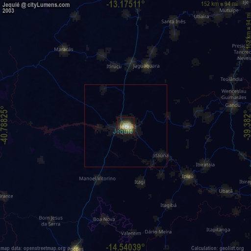
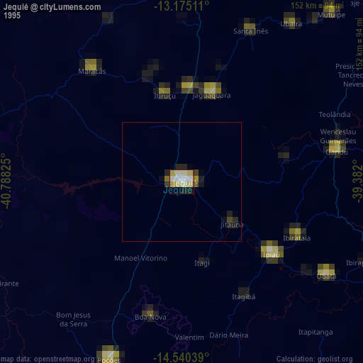
» NASA, Earths city lights 1995
» NASA city lights 2003
» Earth at Night: Flat Maps 2012, 2016