Esperantinópolis night lights from space
Night Light of Esperantinópolis (Maranhão) from space (Brazil) Src. Average luminocity for 10x10km area is 0.031% and for 50x50km: 1.304%.
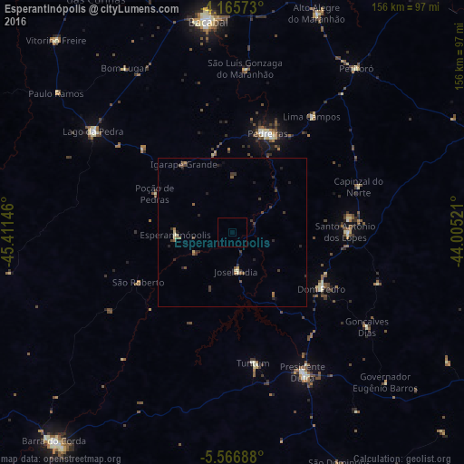
Analysis of Esperantinópolis night lights 2016
Square area 10x10 km:
 0%
0%90-99
0%80-89
0%70-79
0%60-69
0%50-59
0%40-49
0%30-39
0%20-29
0%10-19
0%0-9
100%Square area 50x50 km:
0%90-99
0.09%80-89
0.19%70-79
0.07%60-69
0.14%50-59
0.38%40-49
0.29%30-39
0.48%20-29
0.58%10-19
0.29%0-9
97.5%Clear (daylight) street map image can be seen on geolist.org.
Map coordinates:
4° 9' 56.6" South, 45° 24' 41.3" West
4° 52' 0" South, 44° 42' 30" West
5° 34' 0.8" South, 44° 0' 18.8" West
Some cities around Esperantinópolis sort by population:
• Bacabal
64.6 km =40.1 mi,  351°
351°
• Presidente Dutra
52.9 km =32.9 mi,  152°
152°
• Lago da Pedra
87.2 km =54.2 mi,  317°
317°
• São Domingos do Maranhão
86.6 km =53.8 mi,  155°
155°
• Tuntum
44 km =27.3 mi,  171°
171°
• Dom Pedro
35.4 km =22 mi,  122°
122°
• Poção de Pedras
27.2 km =16.9 mi, 324°
• Paulo Ramos
89.4 km =55.6 mi, 323°
3400739 (p: 13,166)
Sources (retrieved 2019-11-25):
» Earth at Night: Flat Maps 2012, 2016