Dourados night lights from space
Night Light of Dourados (Mato Grosso do Sul) from space (Brazil) Src. Average luminocity for 10x10km area is 66.3598% and for 50x50km: 6.3464%.
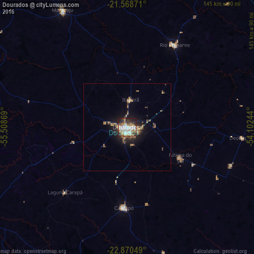
Analysis of Dourados night lights 2016
Square area 10x10 km:
 16.1%
16.1%90-99
18.75%80-89
7.95%70-79
8.9%60-69
10.42%50-59
3.22%40-49
8.33%30-39
7.2%20-29
14.2%10-19
4.92%0-9
0%Square area 50x50 km:
0.71%90-99
0.82%80-89
1.04%70-79
0.82%60-69
1.25%50-59
0.53%40-49
0.86%30-39
0.94%20-29
1.78%10-19
4.09%0-9
87.14%Clear (daylight) street map image can be seen on geolist.org.
Map coordinates:
21° 34' 7.4" South, 55° 30' 31.3" West
22° 13' 16" South, 54° 48' 20" West
22° 52' 13.8" South, 54° 6' 8.8" West
Some cities around Dourados sort by population:
• Pedro Juan Caballero, PY
102 km =63.4 mi,  249°
249°
• Ponta Porã
100.9 km =62.7 mi, 249°
• Naviraí
113.1 km =70.3 mi,  146°
146°
• Maracaju
77.1 km =47.9 mi,  330°
330°
• Rio Brilhante
53.7 km =33.4 mi,  29°
29°
• Caarapó
46 km =28.6 mi,  182°
182°
• Costa Rica
133.9 km =83.2 mi,  173°
173°
• Capitán Bado, PY
138.1 km =85.8 mi,  212°
212°
3464460 (p: 162,202)
Sources (retrieved 2019-11-25):
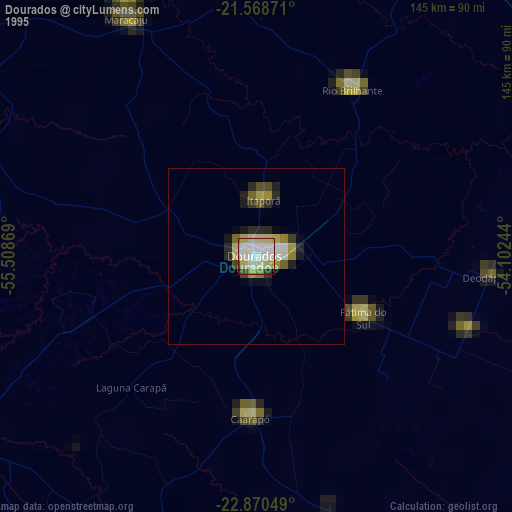
» NASA, Earths city lights 1995
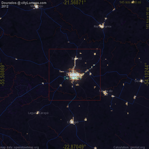
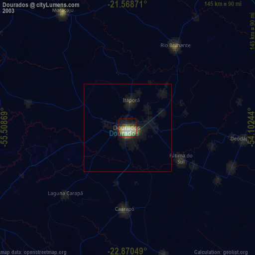
» NASA city lights 2003
» Earth at Night: Flat Maps 2012, 2016