Cordeirópolis night lights from space
Night Light of Cordeirópolis (São Paulo) from space (Brazil) Src. Average luminocity for 10x10km area is 35.7576% and for 50x50km: 23.5714%.
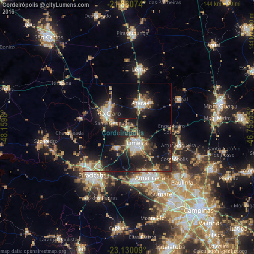
Analysis of Cordeirópolis night lights 2016
Square area 10x10 km:
 0.57%
0.57%90-99
1.89%80-89
3.79%70-79
9.28%60-69
6.06%50-59
7.01%40-49
4.92%30-39
11.36%20-29
15.34%10-19
39.77%0-9
0%Square area 50x50 km:
3.17%90-99
3.17%80-89
2.29%70-79
3.97%60-69
2.89%50-59
2.88%40-49
3.3%30-39
4.25%20-29
8.34%10-19
18.85%0-9
46.89%Clear (daylight) street map image can be seen on geolist.org.
Map coordinates:
21° 49' 50.7" South, 48° 9' 35.3" West
22° 28' 55" South, 47° 27' 24" West
23° 7' 48.3" South, 46° 45' 12.8" West
Some cities around Cordeirópolis sort by population:
• Limeira
10.8 km =6.7 mi,  148°
148°
• Americana
31.4 km =19.5 mi,  155°
155°
• Santa Bárbara d'Oeste
30.5 km =19 mi,  171°
171°
• Rio Claro
13.3 km =8.3 mi,  306°
306°
• Araras
15.8 km =9.8 mi,  28°
28°
• Artur Nogueira
30.9 km =19.2 mi,  109°
109°
• Santa Gertrudes
8.1 km =5 mi,  290°
290°
• Iracemápolis
12.7 km =7.9 mi,  210°
210°
3465524 (p: 25,630)
Sources (retrieved 2019-11-25):
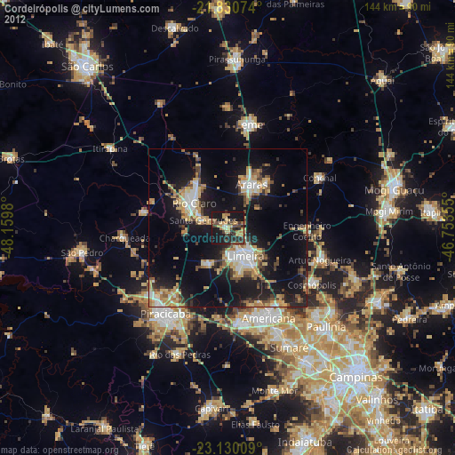
» Earth at Night: Flat Maps 2012, 2016