Colombo night lights from space
Night Light of Colombo (Paraná) from space (Brazil) Src. Average luminocity for 10x10km area is 43.2937% and for 50x50km: 30.3737%.
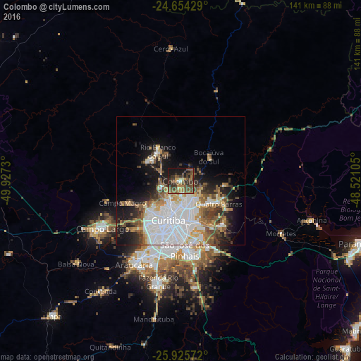
Analysis of Colombo night lights 2016
Square area 10x10 km:
 0.99%
0.99%90-99
1.98%80-89
2.78%70-79
6.55%60-69
11.31%50-59
15.48%40-49
16.67%30-39
12.7%20-29
11.9%10-19
19.25%0-9
0.4%Square area 50x50 km:
9.28%90-99
6.04%80-89
2.31%70-79
3.18%60-69
3.66%50-59
4.48%40-49
3.74%30-39
3.6%20-29
4.35%10-19
10.52%0-9
48.86%Clear (daylight) street map image can be seen on geolist.org.
Map coordinates:
24° 39' 15.4" South, 49° 55' 38.3" West
25° 17' 30" South, 49° 13' 27" West
25° 55' 32.6" South, 48° 31' 15.8" West
Some cities around Colombo sort by population:
• Curitiba
15.9 km =9.9 mi,  197°
197°
• Pinhais
17.3 km =10.7 mi,  169°
169°
• Almirante Tamandaré
9.4 km =5.8 mi,  246°
246°
• Piraquara
23 km =14.3 mi,  136°
136°
• Campina Grande do Sul
17 km =10.6 mi,  95°
95°
• Itaperuçu
14.8 km =9.2 mi,  302°
302°
• Rio Branco do Sul
14.5 km =9 mi,  321°
321°
• Quatro Barras
16.9 km =10.5 mi,  119°
119°
3465927 (p: 217,000)
Sources (retrieved 2019-11-25):
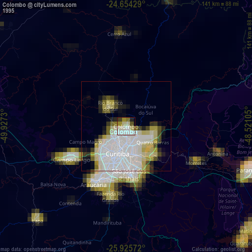
» NASA, Earths city lights 1995
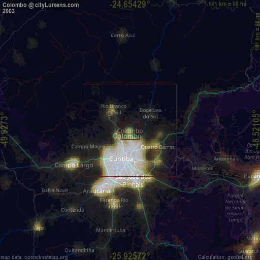
» NASA city lights 2003
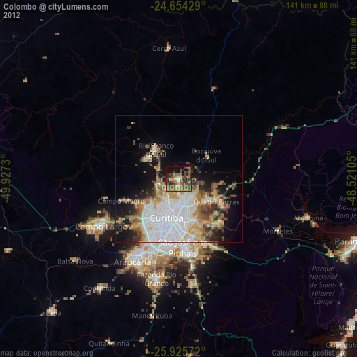
» Earth at Night: Flat Maps 2012, 2016