Mococa night lights from space
Night Light of Mococa (São Paulo) from space (Brazil) Src. Average luminocity for 10x10km area is 33.8996% and for 50x50km: 4.319%.
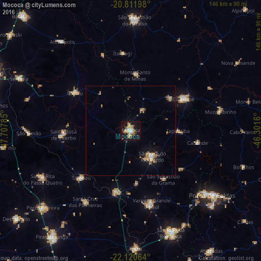
Analysis of Mococa night lights 2016
Square area 10x10 km:
 4.36%
4.36%90-99
3.41%80-89
5.49%70-79
8.33%60-69
5.68%50-59
2.46%40-49
3.98%30-39
3.98%20-29
4.55%10-19
36.93%0-9
20.83%Square area 50x50 km:
0.3%90-99
0.4%80-89
0.51%70-79
0.91%60-69
0.81%50-59
0.4%40-49
0.55%30-39
0.56%20-29
0.57%10-19
3.62%0-9
91.36%Clear (daylight) street map image can be seen on geolist.org.
Map coordinates:
20° 48' 43.1" South, 47° 42' 28.3" West
21° 28' 4" South, 47° 0' 17" West
22° 7' 14.3" South, 46° 18' 5.8" West
Some cities around Mococa sort by population:
• Guaxupé
35.2 km =21.9 mi,  59°
59°
• São José do Rio Pardo
18.6 km =11.6 mi,  139°
139°
• Casa Branca
35.1 km =21.8 mi,  193°
193°
• Santa Rosa de Viterbo
37.1 km =23.1 mi,  269°
269°
• Cajuru
37.7 km =23.4 mi,  304°
304°
• Guaranésia
28.1 km =17.5 mi,  48°
48°
• Monte Santo de Minas
31 km =19.3 mi,  4°
4°
• Caconde
38 km =23.6 mi,  100°
100°
3457025 (p: 59,654)
Sources (retrieved 2019-11-25):
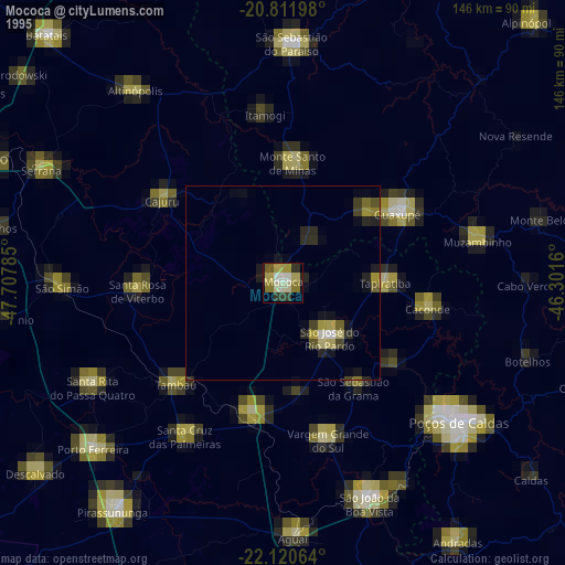
» NASA, Earths city lights 1995
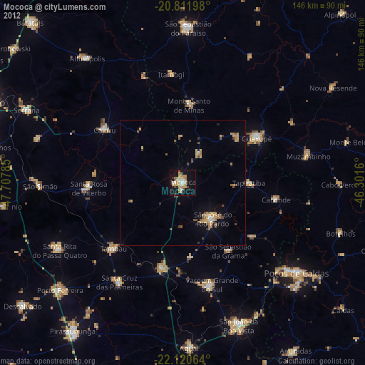
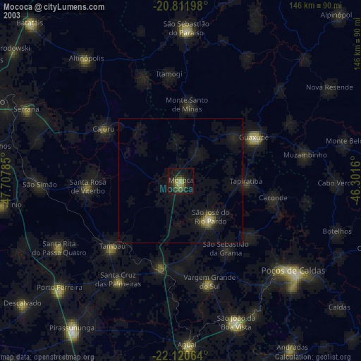
» NASA city lights 2003
» Earth at Night: Flat Maps 2012, 2016