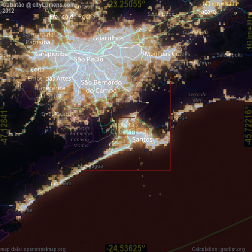
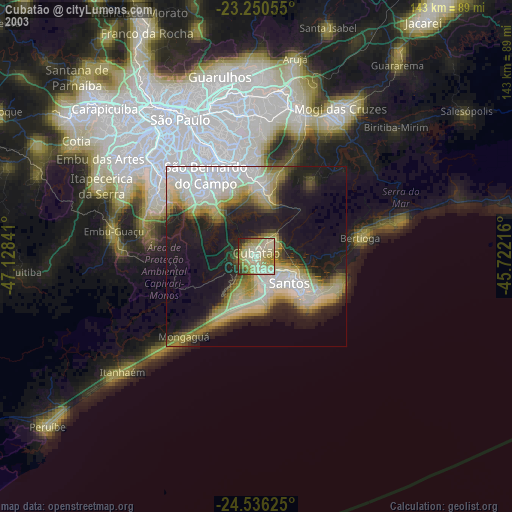
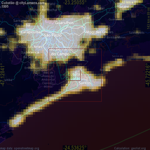
Cubatão night lights from space
Night Light of Cubatão (São Paulo) from space (Brazil) Src. Average luminocity for 10x10km area is 74.9544% and for 50x50km: 38.509%.
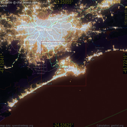
Analysis of Cubatão night lights 2016
Square area 10x10 km:
 13.29%
90-99
14.88%80-89
12.5%70-79
17.26%60-69
19.84%50-59
15.08%40-49
3.77%30-39
2.78%20-29
0.6%10-19
0%0-9
0%Square area 50x50 km:
10.05%90-99
6.2%80-89
2.81%70-79
4.65%60-69
7.4%50-59
6.29%40-49
4.88%30-39
5.01%20-29
8.05%10-19
13.26%0-9
31.41%Clear (daylight) street map image can be seen on geolist.org.
Map coordinates:
23° 15' 2" South, 47° 7' 42.3" West
23° 53' 42" South, 46° 25' 31" West
24° 32' 10.5" South, 45° 43' 19.8" West
Some cities around Cubatão sort by population:
• São Bernardo do Campo
26.5 km =16.5 mi,  327°
327°
• Santos
11.8 km =7.3 mi,  128°
128°
• Mauá
25.5 km =15.8 mi,  351°
351°
• São Vicente
8.3 km =5.2 mi,  155°
155°
• Guarujá
20.3 km =12.6 mi,  122°
122°
• Praia Grande
12.5 km =7.8 mi,  169°
169°
• Ribeirão Pires
20.5 km =12.7 mi,  3°
3°
• Rio Grande da Serra
17 km =10.6 mi,  9°
9°
3465059 (p: 118,410)
Sources (retrieved 2019-11-25):
» NASA, Earths city lights 1995
» NASA city lights 2003
» Earth at Night: Flat Maps 2012, 2016