Andrelândia night lights from space
Night Light of Andrelândia (Minas Gerais) from space (Brazil) Src. Average luminocity for 10x10km area is 4.8968% and for 50x50km: 0.5635%.
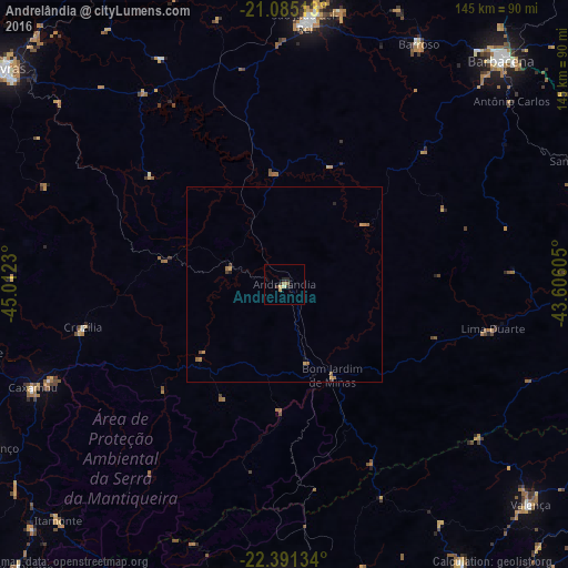
Analysis of Andrelândia night lights 2016
Square area 10x10 km:
 0%
0%90-99
0.6%80-89
0.6%70-79
1.19%60-69
1.59%50-59
0%40-49
0.6%30-39
0.4%20-29
3.17%10-19
0.6%0-9
91.27%Square area 50x50 km:
0%90-99
0.02%80-89
0.05%70-79
0.15%60-69
0.23%50-59
0.12%40-49
0.09%30-39
0.06%20-29
0.19%10-19
0.06%0-9
99.03%Clear (daylight) street map image can be seen on geolist.org.
Map coordinates:
21° 5' 6.5" South, 45° 0' 44.3" West
21° 44' 23" South, 44° 18' 33" West
22° 23' 28.8" South, 43° 36' 21.8" West
Some cities around Andrelândia sort by population:
• São João del Rei
67.4 km =41.9 mi,  4°
4°
• Caxambu
69.5 km =43.2 mi,  247°
247°
• Barroso
70.5 km =43.8 mi,  29°
29°
• Lima Duarte
54.5 km =33.9 mi,  102°
102°
• Baependi
64.7 km =40.2 mi, 247°
• Cruzília
52.7 km =32.7 mi,  257°
257°
• Porto Real
75.6 km =47 mi,  178°
178°
• Quatis
74.4 km =46.2 mi, 175°
3472245 (p: 10,079)
Sources (retrieved 2019-11-25):
» Earth at Night: Flat Maps 2012, 2016