Stamboliyski night lights from space
Night Light of Stamboliyski (Plovdiv) from space (Bulgaria) Src. Average luminocity for 10x10km area is 8.7227% and for 50x50km: 9.4417%.
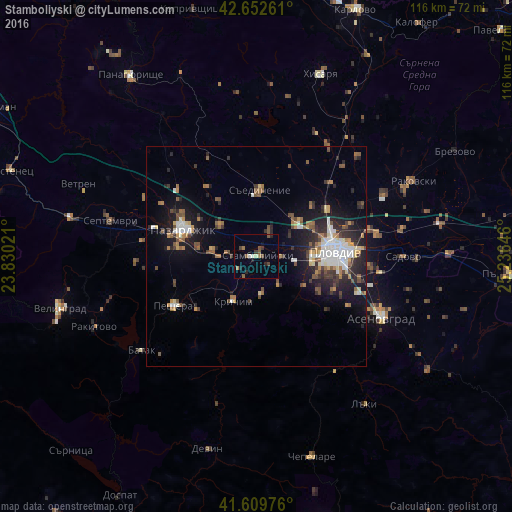
Analysis of Stamboliyski night lights 2016
Square area 10x10 km:
 0%
0%90-99
1.21%80-89
0.61%70-79
0%60-69
1.82%50-59
1.97%40-49
2.58%30-39
1.52%20-29
1.97%10-19
1.67%0-9
86.67%Square area 50x50 km:
1.38%90-99
1.46%80-89
0.67%70-79
1.02%60-69
1.19%50-59
1.55%40-49
1.27%30-39
1.54%20-29
3%10-19
6.29%0-9
80.62%Clear (daylight) street map image can be seen on geolist.org.
Map coordinates:
42° 39' 9.4" North, 23° 49' 48.8" East
42° 7' 60" North, 24° 31' 60" East
41° 36' 35.1" North, 25° 14' 11.3" East
Some cities around Stamboliyski sort by population:
• Plovdiv
18 km =11.2 mi,  84°
84°
• Pazardzhik
18.1 km =11.2 mi,  294°
294°
• Asenovgrad
30.4 km =18.9 mi,  115°
115°
• Peshtera
22.2 km =13.8 mi,  240°
240°
• Septemvri
34.4 km =21.4 mi,  284°
284°
• Krichim
10.8 km =6.7 mi,  210°
210°
• Saedinenie
14.9 km =9.3 mi,  5°
5°
• Perushtitsa
9.4 km =5.8 mi,  171°
171°
726890 (p: 12,070)
Sources (retrieved 2019-11-25):
» Earth at Night: Flat Maps 2012, 2016