Dimitrovgrad night lights from space
Night Light of Dimitrovgrad (Haskovo) from space (Bulgaria) Src. Average luminocity for 10x10km area is 23.7159% and for 50x50km: 4.145%.
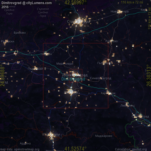
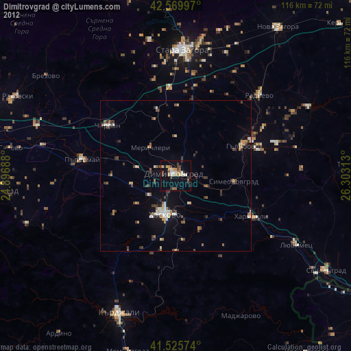
Analysis of Dimitrovgrad night lights 2016
Square area 10x10 km:
 3.02%
3.02%90-99
5.24%80-89
0.63%70-79
3.97%60-69
1.75%50-59
3.81%40-49
1.59%30-39
1.59%20-29
4.29%10-19
30.95%0-9
43.17%Square area 50x50 km:
0.3%90-99
0.5%80-89
0.36%70-79
0.52%60-69
0.58%50-59
0.89%40-49
0.54%30-39
0.61%20-29
0.87%10-19
3.3%0-9
91.54%Clear (daylight) street map image can be seen on geolist.org.
Map coordinates:
42° 34' 11.9" North, 24° 53' 48.8" East
42° 3' 0" North, 25° 36' 0" East
41° 31' 32.7" North, 26° 18' 11.3" East
Some cities around Dimitrovgrad sort by population:
• Stara Zagora
42.7 km =26.5 mi,  4°
4°
• Haskovo
13.4 km =8.3 mi,  195°
195°
• Harmanli
28 km =17.4 mi,  117°
117°
• Chirpan
27.6 km =17.1 mi,  307°
307°
• Parvomay
32.1 km =19.9 mi,  279°
279°
• Radnevo
39.1 km =24.3 mi,  44°
44°
• Gŭlŭbovo
22.6 km =14 mi,  65°
65°
• Simeonovgrad
19.4 km =12.1 mi,  95°
95°
732263 (p: 43,288)
Sources (retrieved 2019-11-25):
» Earth at Night: Flat Maps 2012, 2016