Dolni Chiflik night lights from space
Night Light of Dolni Chiflik (Varna) from space (Bulgaria) Src. Average luminocity for 10x10km area is 4.5% and for 50x50km: 3.454%.
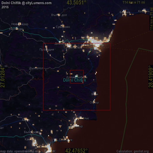
Analysis of Dolni Chiflik night lights 2016
Square area 10x10 km:
 0.16%
0.16%90-99
0.48%80-89
0.63%70-79
0%60-69
0.48%50-59
1.43%40-49
1.11%30-39
1.9%20-29
1.43%10-19
0.32%0-9
92.06%Square area 50x50 km:
0.35%90-99
0.52%80-89
0.32%70-79
0.16%60-69
0.46%50-59
0.66%40-49
0.51%30-39
0.66%20-29
1.55%10-19
2.01%0-9
92.81%Clear (daylight) street map image can be seen on geolist.org.
Map coordinates:
43° 30' 18.4" North, 27° 0' 46.2" East
42° 59' 34.7" North, 27° 42' 57.5" East
42° 28' 35.5" North, 28° 25' 8.7" East
Some cities around Dolni Chiflik sort by population:
• Varna
29.7 km =18.5 mi,  33°
33°
• Asparuhovo
25.1 km =15.6 mi, 33°
• Provadia
31.2 km =19.4 mi,  312°
312°
• Devnya
28.1 km =17.5 mi,  334°
334°
• Beloslav
21.9 km =13.6 mi,  357°
357°
• Aksakovo
30.5 km =19 mi,  16°
16°
• Nesebar
37.1 km =23.1 mi,  177°
177°
• Dalgopol
30.4 km =18.9 mi,  282°
282°
731453 (p: 7,169)
Sources (retrieved 2019-11-25):
» Earth at Night: Flat Maps 2012, 2016