Zulte night lights from space
Night Light of Zulte (Flanders) from space (Belgium) Src. Average luminocity for 10x10km area is 49.7507% and for 50x50km: 40.0692%.
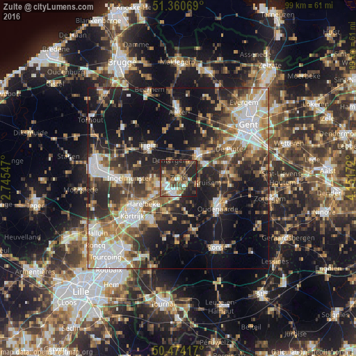
Analysis of Zulte night lights 2016
Square area 10x10 km:
 7%
7%90-99
7.84%80-89
4.62%70-79
5.18%60-69
5.18%50-59
15.55%40-49
10.64%30-39
10.22%20-29
24.79%10-19
8.96%0-9
0%Square area 50x50 km:
7.46%90-99
7.31%80-89
3.99%70-79
4.73%60-69
5.58%50-59
6.54%40-49
5.72%30-39
6.4%20-29
12.36%10-19
20.25%0-9
19.65%Clear (daylight) street map image can be seen on geolist.org.
Map coordinates:
51° 21' 38.5" North, 2° 44' 43.7" East
50° 55' 10.3" North, 3° 26' 54.9" East
50° 28' 27" North, 4° 9' 6.2" East
Some cities around Zulte sort by population:
• Waregem
3.7 km =2.3 mi,  203°
203°
• Deinze
9 km =5.6 mi,  39°
39°
• Anzegem
9.4 km =5.8 mi,  167°
167°
• Deerlijk
9.9 km =6.2 mi,  221°
221°
• Wielsbeke
6.1 km =3.8 mi,  249°
249°
• Kruishoutem
5.8 km =3.6 mi,  110°
110°
• Dentergem
5.5 km =3.4 mi,  335°
335°
• Oostrozebeke
7.8 km =4.8 mi,  271°
271°
2783151 (p: 14,670)
Sources (retrieved 2019-11-25):
» Earth at Night: Flat Maps 2012, 2016