Wielsbeke night lights from space
Night Light of Wielsbeke (Flanders) from space (Belgium) Src. Average luminocity for 10x10km area is 62.8501% and for 50x50km: 38.6711%.
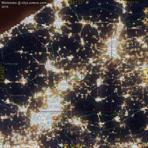
Analysis of Wielsbeke night lights 2016
Square area 10x10 km:
 8.4%
8.4%90-99
11.34%80-89
11.48%70-79
7.28%60-69
11.76%50-59
17.79%40-49
10.92%30-39
9.66%20-29
11.06%10-19
0.28%0-9
0%Square area 50x50 km:
7.4%90-99
6.65%80-89
3.64%70-79
4.43%60-69
5.24%50-59
6.49%40-49
5.74%30-39
6.68%20-29
12.28%10-19
19.7%0-9
21.75%Clear (daylight) street map image can be seen on geolist.org.
Map coordinates:
51° 20' 28.8" North, 2° 39' 48.8" East
50° 54' 0" North, 3° 22' 0" East
50° 27' 16" North, 4° 4' 11.3" East
Some cities around Wielsbeke sort by population:
• Waregem
4.4 km =2.7 mi,  106°
106°
• Harelbeke
6.6 km =4.1 mi,  217°
217°
• Zulte
6.1 km =3.8 mi,  69°
69°
• Kuurne
8 km =5 mi,  227°
227°
• Deerlijk
5.3 km =3.3 mi,  189°
189°
• Meulebeke
7.9 km =4.9 mi,  316°
316°
• Dentergem
7.9 km =4.9 mi,  25°
25°
• Oostrozebeke
3.1 km =1.9 mi, 319°
2783717 (p: 8,828)
Sources (retrieved 2019-11-25):
» Earth at Night: Flat Maps 2012, 2016