Tielt night lights from space
Night Light of Tielt (Flanders) from space (Belgium) Src. Average luminocity for 10x10km area is 26.0508% and for 50x50km: 35.8775%.
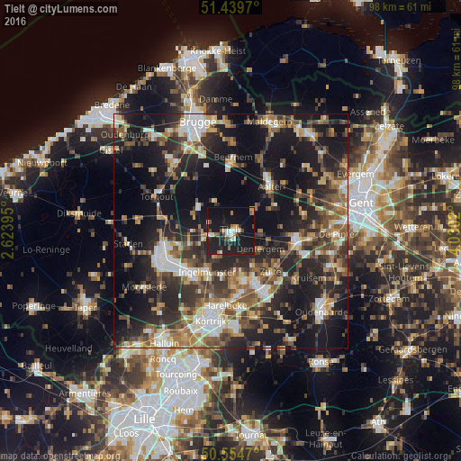
Analysis of Tielt night lights 2016
Square area 10x10 km:
 3.21%
3.21%90-99
3.61%80-89
1.87%70-79
2.94%60-69
2.14%50-59
2.94%40-49
2.54%30-39
1.2%20-29
11.9%10-19
49.33%0-9
18.32%Square area 50x50 km:
4.39%90-99
5.87%80-89
3.48%70-79
4.22%60-69
5.19%50-59
6.44%40-49
6.1%30-39
6.7%20-29
13.59%10-19
25.99%0-9
18.04%Clear (daylight) street map image can be seen on geolist.org.
Map coordinates:
51° 26' 22.9" North, 2° 37' 26.2" East
50° 59' 57.5" North, 3° 19' 37.5" East
50° 33' 16.9" North, 4° 1' 48.7" East
Some cities around Tielt sort by population:
• Wingene
7.5 km =4.7 mi,  330°
330°
• Meulebeke
6 km =3.7 mi,  207°
207°
• Ingelmunster
10.1 km =6.3 mi, 209°
• Ardooie
9.5 km =5.9 mi,  253°
253°
• Dentergem
7.4 km =4.6 mi,  121°
121°
• Oostrozebeke
8.7 km =5.4 mi,  174°
174°
• Pittem
4.5 km =2.8 mi,  260°
260°
• Ruiselede
6.5 km =4 mi,  45°
45°
2785476 (p: 19,299)
Sources (retrieved 2019-11-25):
» Earth at Night: Flat Maps 2012, 2016