Pittem night lights from space
Night Light of Pittem (Flanders) from space (Belgium) Src. Average luminocity for 10x10km area is 33.0481% and for 50x50km: 33.9014%.
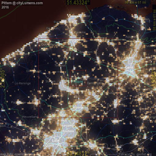
Analysis of Pittem night lights 2016
Square area 10x10 km:
 2.81%
2.81%90-99
3.34%80-89
4.41%70-79
1.2%60-69
6.55%50-59
4.68%40-49
3.07%30-39
8.16%20-29
24.2%10-19
39.57%0-9
2.01%Square area 50x50 km:
4.28%90-99
5.72%80-89
3.53%70-79
3.81%60-69
4.61%50-59
5.56%40-49
5.47%30-39
6.13%20-29
13%10-19
25%0-9
22.9%Clear (daylight) street map image can be seen on geolist.org.
Map coordinates:
51° 25' 59.7" North, 2° 33' 36.2" East
50° 59' 34" North, 3° 15' 47.4" East
50° 32' 53.2" North, 3° 57' 58.7" East
Some cities around Pittem sort by population:
• Izegem
9.4 km =5.8 mi,  201°
201°
• Tielt
4.5 km =2.8 mi,  80°
80°
• Wingene
7.3 km =4.5 mi,  5°
5°
• Meulebeke
4.9 km =3 mi,  159°
159°
• Ingelmunster
8 km =5 mi,  183°
183°
• Ardooie
5 km =3.1 mi,  247°
247°
• Lichtervelde
9.1 km =5.7 mi,  299°
299°
• Oostrozebeke
9.6 km =6 mi,  146°
146°
2788925 (p: 6,589)
Sources (retrieved 2019-11-25):
» Earth at Night: Flat Maps 2012, 2016