Amblève night lights from space
Night Light of Amblève (Wallonia) from space (Belgium) Src. Average luminocity for 10x10km area is 0.1387% and for 50x50km: 1.7101%.
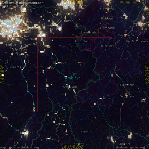
Analysis of Amblève night lights 2016
Square area 10x10 km:
 0%
0%90-99
0%80-89
0%70-79
0%60-69
0%50-59
0%40-49
0%30-39
0%20-29
0%10-19
0%0-9
100%Square area 50x50 km:
0.16%90-99
0.25%80-89
0.13%70-79
0.17%60-69
0.19%50-59
0.27%40-49
0.38%30-39
0.26%20-29
0.37%10-19
1.37%0-9
96.44%Clear (daylight) street map image can be seen on geolist.org.
Map coordinates:
50° 48' 0.3" North, 5° 28' 0.8" East
50° 21' 12.9" North, 6° 10' 12.1" East
49° 54' 10.2" North, 6° 52' 23.3" East
Some cities around Amblève sort by population:
• Monschau, DE
22.9 km =14.2 mi,  12°
12°
• Malmédy
13 km =8.1 mi,  308°
308°
• Saint-Vith
8.6 km =5.3 mi,  200°
200°
• Vielsalm
19.7 km =12.2 mi,  246°
246°
• Waimes
8 km =5 mi,  328°
328°
• Stavelot
17.5 km =10.9 mi,  285°
285°
• Butgenbach
8.5 km =5.3 mi,  16°
16°
• Bullange
8.6 km =5.3 mi,  46°
46°
2803242 (p: 5,221)
Sources (retrieved 2019-11-25):
» Earth at Night: Flat Maps 2012, 2016