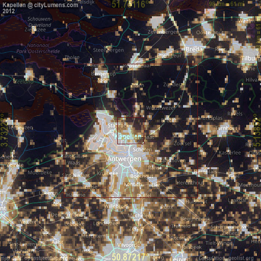
Kapellen night lights from space
Night Light of Kapellen (Flanders) from space (Belgium) Src. Average luminocity for 10x10km area is 61.888% and for 50x50km: 38.8719%.
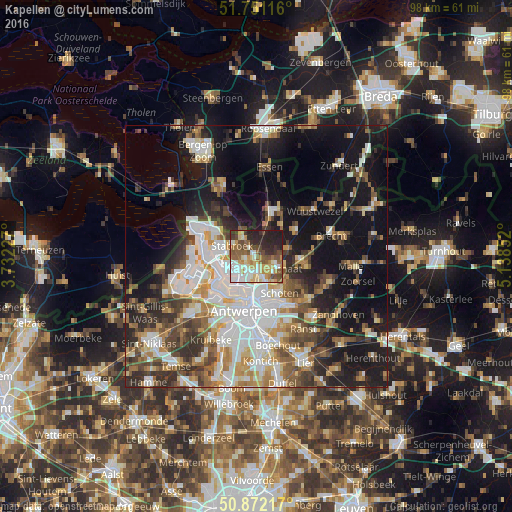
Analysis of Kapellen night lights 2016
Square area 10x10 km:
 10.08%
90-99
14.57%80-89
10.5%70-79
9.52%60-69
6.44%50-59
11.76%40-49
10.08%30-39
5.88%20-29
16.11%10-19
5.04%0-9
0%Square area 50x50 km:
8.75%90-99
7.94%80-89
3.85%70-79
4.31%60-69
4.71%50-59
4.97%40-49
5.67%30-39
5.48%20-29
7.84%10-19
21.5%0-9
24.97%Clear (daylight) street map image can be seen on geolist.org.
Map coordinates:
51° 45' 4.2" North, 3° 43' 56.2" East
51° 18' 49.6" North, 4° 26' 7.4" East
50° 52' 19.8" North, 5° 8' 18.7" East
Some cities around Kapellen sort by population:
• Antwerpen
10.7 km =6.6 mi,  192°
192°
• Deurne
10.5 km =6.5 mi,  168°
168°
• Brasschaat
4.7 km =2.9 mi,  122°
122°
• Schoten
8.3 km =5.2 mi,  145°
145°
• Zwijndrecht
12.9 km =8 mi,  215°
215°
• Kalmthout
8.3 km =5.2 mi,  19°
19°
• Stabroek
4.9 km =3 mi,  294°
294°
• Wijnegem
11.2 km =7 mi, 148°
2794730 (p: 26,410)
Sources (retrieved 2019-11-25):
» Earth at Night: Flat Maps 2012, 2016