Leuven night lights from space
Night Light of Leuven (Flanders) from space (Belgium) Src. Average luminocity for 10x10km area is 67.2325% and for 50x50km: 40.5804%.
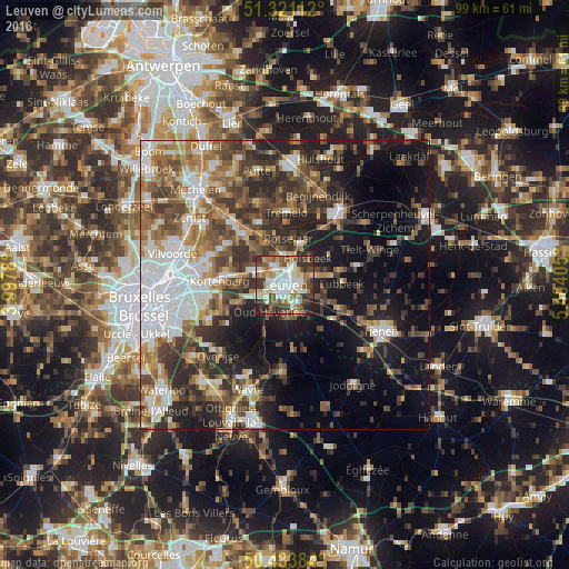
Analysis of Leuven night lights 2016
Square area 10x10 km:
 15.41%
90-99
19.75%80-89
6.72%70-79
5.88%60-69
8.54%50-59
9.94%40-49
10.22%30-39
14.43%20-29
8.26%10-19
0.84%0-9
0%Square area 50x50 km:
8.57%90-99
6.74%80-89
3.26%70-79
4.6%60-69
6.35%50-59
6.8%40-49
7.48%30-39
8.08%20-29
9.76%10-19
14.92%0-9
23.43%Clear (daylight) street map image can be seen on geolist.org.
Map coordinates:
51° 19' 16" North, 3° 59' 52.1" East
50° 52' 46.5" North, 4° 42' 3.3" East
50° 26' 1.8" North, 5° 24' 14.6" East
Some cities around Leuven sort by population:
• Herent
3.9 km =2.4 mi,  326°
326°
• Rotselaar
8.2 km =5.1 mi,  7°
7°
• Lubbeek
9.7 km =6 mi,  87°
87°
• Oud-Heverlee
5.6 km =3.5 mi,  207°
207°
• Bertem
5.3 km =3.3 mi,  251°
251°
• Holsbeek
6.1 km =3.8 mi,  40°
40°
• Bierbeek
7 km =4.3 mi,  143°
143°
• Boutersem
10.6 km =6.6 mi,  117°
117°
2792482 (p: 92,892)
Sources (retrieved 2019-11-25):
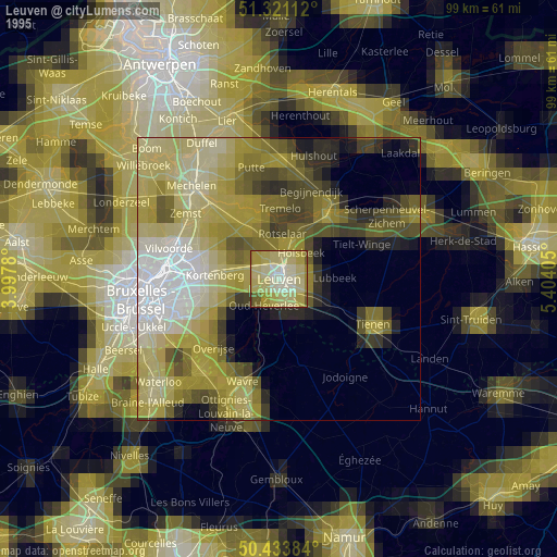
» NASA, Earths city lights 1995
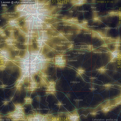
» NASA city lights 2003
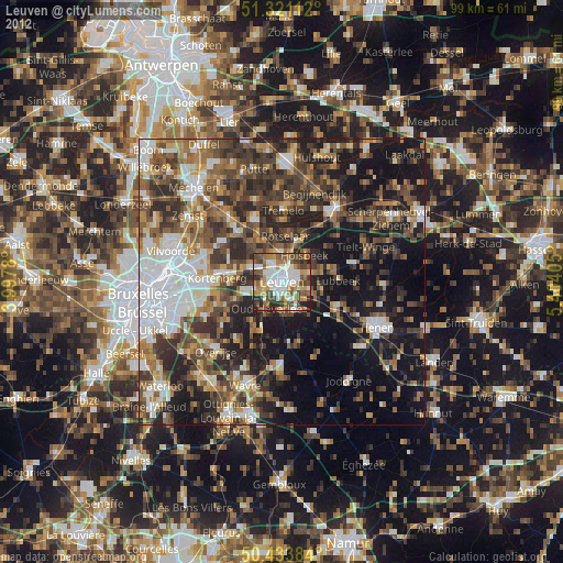
» Earth at Night: Flat Maps 2012, 2016