Butgenbach night lights from space
Night Light of Butgenbach (Wallonia) from space (Belgium) Src. Average luminocity for 10x10km area is 0.9986% and for 50x50km: 2.9233%.
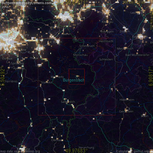
Analysis of Butgenbach night lights 2016
Square area 10x10 km:
 0%
0%90-99
0%80-89
0%70-79
0%60-69
0.56%50-59
0%40-49
0.42%30-39
0.7%20-29
0.56%10-19
0.28%0-9
97.48%Square area 50x50 km:
0.44%90-99
0.49%80-89
0.2%70-79
0.23%60-69
0.37%50-59
0.41%40-49
0.59%30-39
0.47%20-29
0.56%10-19
2.47%0-9
93.78%Clear (daylight) street map image can be seen on geolist.org.
Map coordinates:
50° 52' 21.8" North, 5° 30' 6.9" East
50° 25' 36.8" North, 6° 12' 18.1" East
49° 58' 36.6" North, 6° 54' 29.4" East
Some cities around Butgenbach sort by population:
• Monschau, DE
14.4 km =8.9 mi,  9°
9°
• Malmédy
12.5 km =7.8 mi,  269°
269°
• Saint-Vith
17.1 km =10.6 mi,  198°
198°
• Hellenthal, DE
17.3 km =10.7 mi,  68°
68°
• Waimes
6.7 km =4.2 mi,  258°
258°
• Stavelot
19.7 km =12.2 mi, 259°
• Bullange
4.3 km =2.7 mi,  120°
120°
• Amblève
8.5 km =5.3 mi, 196°
2800711 (p: 5,516)
Sources (retrieved 2019-11-25):
» Earth at Night: Flat Maps 2012, 2016