Stijena night lights from space
Night Light of Stijena (Federation of B&H) from space (Bosnia and Herzegovina) Src. Average luminocity for 10x10km area is 0.2063% and for 50x50km: 1.2772%.
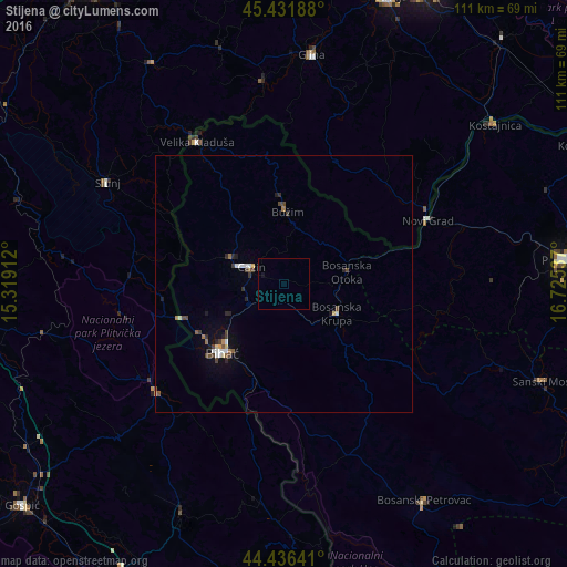
Analysis of Stijena night lights 2016
Square area 10x10 km:
 0%
0%90-99
0%80-89
0%70-79
0%60-69
0%50-59
0%40-49
0%30-39
0%20-29
0%10-19
0.63%0-9
99.37%Square area 50x50 km:
0.15%90-99
0.22%80-89
0.1%70-79
0.07%60-69
0.16%50-59
0.14%40-49
0.34%30-39
0.22%20-29
0.28%10-19
0.42%0-9
97.9%Clear (daylight) street map image can be seen on geolist.org.
Map coordinates:
45° 25' 54.8" North, 15° 19' 8.8" East
44° 56' 10.7" North, 16° 1' 20.1" East
44° 26' 11.1" North, 16° 43' 31.3" East
Some cities around Stijena sort by population:
• Cazin
7.1 km =4.4 mi,  298°
298°
• Bosanska Krupa
11.8 km =7.3 mi,  120°
120°
• Bužim
13.1 km =8.1 mi,  3°
3°
• Otoka
12.6 km =7.8 mi,  77°
77°
• Varoška Rijeka
17 km =10.6 mi,  359°
359°
• Pećigrad
16.4 km =10.2 mi,  323°
323°
• Ostrožac
7.1 km =4.4 mi,  244°
244°
• Ćoralići
14.2 km =8.8 mi, 303°
3189884 (p: 10,844)
Sources (retrieved 2019-11-25):
» Earth at Night: Flat Maps 2012, 2016