Ostrožac night lights from space
Night Light of Ostrožac (Federation of B&H) from space (Bosnia and Herzegovina) Src. Average luminocity for 10x10km area is 1.4444% and for 50x50km: 1.3422%.
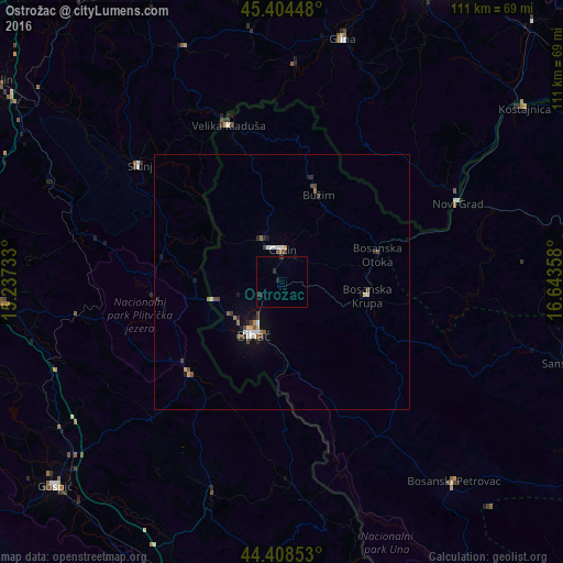
Analysis of Ostrožac night lights 2016
Square area 10x10 km:
 0%
0%90-99
0%80-89
0%70-79
0%60-69
0%50-59
0%40-49
0%30-39
0.32%20-29
2.54%10-19
0.32%0-9
96.83%Square area 50x50 km:
0.15%90-99
0.22%80-89
0.1%70-79
0.1%60-69
0.16%50-59
0.14%40-49
0.36%30-39
0.23%20-29
0.32%10-19
0.46%0-9
97.76%Clear (daylight) street map image can be seen on geolist.org.
Map coordinates:
45° 24' 16.1" North, 15° 14' 14.4" East
44° 54' 31.2" North, 15° 56' 25.6" East
44° 24' 30.7" North, 16° 38' 36.9" East
Some cities around Ostrožac sort by population:
• Bihać
11.6 km =7.2 mi,  208°
208°
• Cazin
6.5 km =4 mi,  1°
1°
• Bosanska Krupa
16.9 km =10.5 mi,  99°
99°
• Stijena
7.1 km =4.4 mi,  64°
64°
• Bužim
17.7 km =11 mi,  24°
24°
• Tržačka Raštela
14.3 km =8.9 mi,  301°
301°
• Pećigrad
16.6 km =10.3 mi,  348°
348°
• Ćoralići
12.2 km =7.6 mi,  333°
333°
3193821 (p: 5,456)
Sources (retrieved 2019-11-25):
» Earth at Night: Flat Maps 2012, 2016