Kladanj night lights from space
Night Light of Kladanj (Federation of B&H) from space (Bosnia and Herzegovina) Src. Average luminocity for 10x10km area is 0.897% and for 50x50km: 1.0254%.
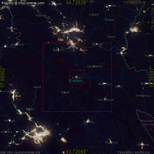
Analysis of Kladanj night lights 2016
Square area 10x10 km:
 0%
0%90-99
0%80-89
0%70-79
0.61%60-69
0%50-59
0%40-49
0.61%30-39
0%20-29
0%10-19
0.61%0-9
98.18%Square area 50x50 km:
0.07%90-99
0.1%80-89
0.01%70-79
0.09%60-69
0.2%50-59
0.2%40-49
0.3%30-39
0.29%20-29
0.28%10-19
0.53%0-9
97.93%Clear (daylight) street map image can be seen on geolist.org.
Map coordinates:
44° 43' 42.2" North, 17° 59' 22.6" East
44° 13' 36.1" North, 18° 41' 33.9" East
43° 43' 14.4" North, 19° 23' 45.1" East
Some cities around Kladanj sort by population:
• Tuzla
34.7 km =21.6 mi,  356°
356°
• Živinice
25 km =15.5 mi,  352°
352°
• Sokolac
33.2 km =20.6 mi,  164°
164°
• Milići
32.4 km =20.1 mi,  101°
101°
• Banovići
23.9 km =14.9 mi,  326°
326°
• Vareš
29.9 km =18.6 mi,  256°
256°
• Tojšići
31.4 km =19.5 mi,  13°
13°
• Šekovići
15.2 km =9.4 mi,  58°
58°
3198126 (p: 6,783)
Sources (retrieved 2019-11-25):
» Earth at Night: Flat Maps 2012, 2016