Donji Vakuf night lights from space
Night Light of Donji Vakuf (Federation of B&H) from space (Bosnia and Herzegovina) Src. Average luminocity for 10x10km area is 0.8318% and for 50x50km: 1.4227%.
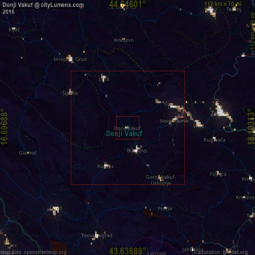
Analysis of Donji Vakuf night lights 2016
Square area 10x10 km:
 0%
0%90-99
0%80-89
0%70-79
0.15%60-69
0.45%50-59
0.45%40-49
0.15%30-39
0%20-29
0%10-19
0%0-9
98.79%Square area 50x50 km:
0.08%90-99
0.23%80-89
0.08%70-79
0.03%60-69
0.24%50-59
0.28%40-49
0.52%30-39
0.29%20-29
0.35%10-19
0.41%0-9
97.48%Clear (daylight) street map image can be seen on geolist.org.
Map coordinates:
44° 38' 45.6" North, 16° 41' 48.8" East
44° 8' 37" North, 17° 24' 0" East
43° 38' 12.8" North, 18° 6' 11.3" East
Some cities around Donji Vakuf sort by population:
• Bugojno
10.4 km =6.5 mi,  157°
157°
• Travnik
23.1 km =14.4 mi,  66°
66°
• Šipovo
29.4 km =18.3 mi,  301°
301°
• Novi Travnik
20.8 km =12.9 mi,  81°
81°
• Jajce
24.4 km =15.2 mi,  334°
334°
• Vitez
31.1 km =19.3 mi,  87°
87°
• Divičani
25.5 km =15.8 mi,  346°
346°
• Gornji Vakuf
27.4 km =17 mi,  146°
146°
3201376 (p: 7,955)
Sources (retrieved 2019-11-25):
» Earth at Night: Flat Maps 2012, 2016