Valley View night lights from space
Night Light of Valley View (South Australia) from space (Australia) Src. Average luminocity for 10x10km area is 85.5495% and for 50x50km: 26.859%.
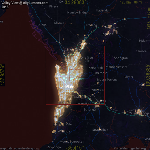
Analysis of Valley View night lights 2016
Square area 10x10 km:
 23.08%
90-99
26.01%80-89
18.32%70-79
17.77%60-69
8.79%50-59
4.4%40-49
0.73%30-39
0.37%20-29
0.55%10-19
0%0-9
0%Square area 50x50 km:
5.75%90-99
6.1%80-89
2.85%70-79
4.78%60-69
3.92%50-59
3.26%40-49
2.48%30-39
2.4%20-29
4.71%10-19
8.65%0-9
55.09%Clear (daylight) street map image can be seen on geolist.org.
Map coordinates:
34° 15' 39" South, 137° 57' 27.4" East
34° 50' 23.8" South, 138° 39' 38.6" East
35° 24' 54" South, 139° 21' 49.9" East
Some cities around Valley View sort by population:
• Ingle Farm
2.6 km =1.6 mi,  286°
286°
• Hope Valley
3.7 km =2.3 mi,  78°
78°
• Pooraka
3.6 km =2.2 mi,  298°
298°
• Para Hills
3.1 km =1.9 mi,  355°
355°
• Northgate
3.5 km =2.2 mi,  235°
235°
• Modbury North
1.8 km =1.1 mi,  43°
43°
• Modbury
2.2 km =1.4 mi,  70°
70°
• Windsor Gardens
3.1 km =1.9 mi,  203°
203°
8349359 (p: 6,007)
Sources (retrieved 2019-11-25):
» Earth at Night: Flat Maps 2012, 2016