Maitland night lights from space
Night Light of Maitland (New South Wales) from space (Australia) Src. Average luminocity for 10x10km area is 34.8409% and for 50x50km: 12.6543%.

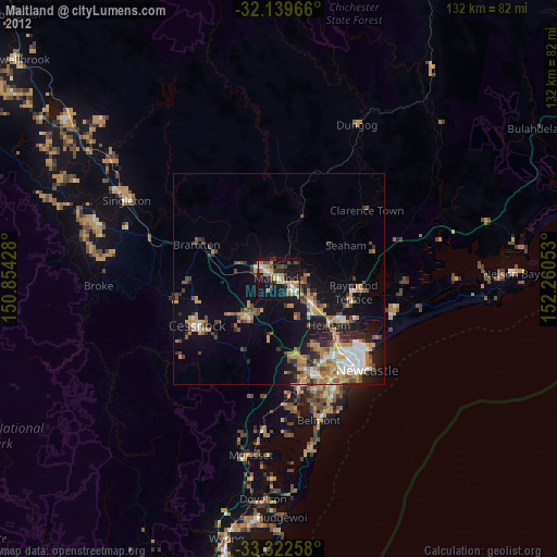

Analysis of Maitland night lights 2016
Square area 10x10 km:
 3.5%
3.5%90-99
4.9%80-89
0.7%70-79
6.47%60-69
12.41%50-59
1.4%40-49
3.15%30-39
9.44%20-29
3.15%10-19
45.63%0-9
9.27%Square area 50x50 km:
1.46%90-99
1.7%80-89
0.36%70-79
2.03%60-69
3.68%50-59
1.63%40-49
1.41%30-39
2.55%20-29
2.79%10-19
8.81%0-9
73.58%Clear (daylight) street map image can be seen on geolist.org.
Map coordinates:
32° 8' 22.8" South, 150° 51' 15.4" East
32° 43' 59.1" South, 151° 33' 26.6" East
33° 19' 21.3" South, 152° 15' 37.9" East
Some cities around Maitland sort by population:
• Raymond Terrace
18.3 km =11.4 mi,  99°
99°
• Rutherford
2.9 km =1.8 mi,  309°
309°
• East Maitland
3.1 km =1.9 mi,  127°
127°
• Thornton
9 km =5.6 mi, 128°
• Maryland
18.9 km =11.7 mi,  149°
149°
• Kurri Kurri
12.1 km =7.5 mi,  217°
217°
• Aberglasslyn
4.3 km =2.7 mi,  328°
328°
• Fletcher
17.3 km =10.7 mi, 153°
2159045 (p: 67,132)
Sources (retrieved 2019-11-25):
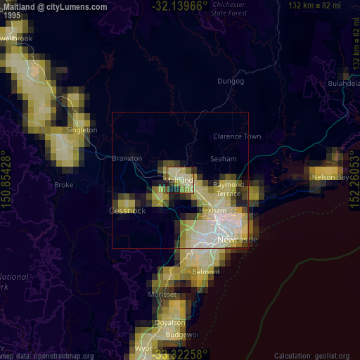
» NASA, Earths city lights 1995
» NASA city lights 2003
» Earth at Night: Flat Maps 2012, 2016