Beckenham night lights from space
Night Light of Beckenham (Western Australia) from space (Australia) Src. Average luminocity for 10x10km area is 84.2972% and for 50x50km: 42.0569%.
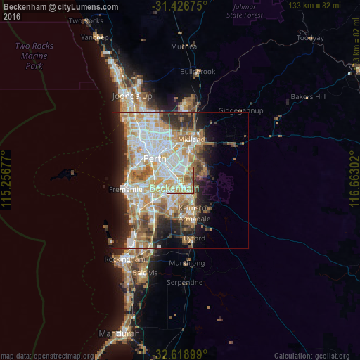
Analysis of Beckenham night lights 2016
Square area 10x10 km:
 22.38%
90-99
25%80-89
14.16%70-79
19.06%60-69
11.54%50-59
5.24%40-49
2.45%30-39
0.17%20-29
0%10-19
0%0-9
0%Square area 50x50 km:
9.38%90-99
10.08%80-89
4.75%70-79
6.29%60-69
8.23%50-59
4.78%40-49
3.52%30-39
3.69%20-29
7.05%10-19
8.45%0-9
33.78%Clear (daylight) street map image can be seen on geolist.org.
Map coordinates:
31° 25' 36.3" South, 115° 15' 24.4" East
32° 1' 29.3" South, 115° 57' 35.6" East
32° 37' 8.4" South, 116° 39' 46.9" East
Some cities around Beckenham sort by population:
• Thornlie
3.9 km =2.4 mi,  186°
186°
• Maddington
3.6 km =2.2 mi,  141°
141°
• Bentley
4.2 km =2.6 mi,  307°
307°
• Queens Park
2.7 km =1.7 mi,  331°
331°
• Cannington
2.4 km =1.5 mi,  293°
293°
• Kenwick
1.1 km =0.7 mi,  145°
145°
• Langford
2.5 km =1.6 mi,  223°
223°
• East Cannington
1.7 km =1.1 mi,  344°
344°
8349023 (p: 7,385)
Sources (retrieved 2019-11-25):
» Earth at Night: Flat Maps 2012, 2016