Hinchinbrook night lights from space
Night Light of Hinchinbrook (New South Wales) from space (Australia) Src. Average luminocity for 10x10km area is 74.6469% and for 50x50km: 48.1846%.
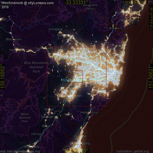
Analysis of Hinchinbrook night lights 2016
Square area 10x10 km:
 14.86%
90-99
21.85%80-89
14.34%70-79
15.38%60-69
11.54%50-59
2.27%40-49
4.02%30-39
7.34%20-29
8.39%10-19
0%0-9
0%Square area 50x50 km:
10.24%90-99
12.03%80-89
6.91%70-79
7.97%60-69
8.77%50-59
4.91%40-49
3.37%30-39
4.49%20-29
5.33%10-19
8.6%0-9
27.36%Clear (daylight) street map image can be seen on geolist.org.
Map coordinates:
33° 19' 59.9" South, 150° 9' 36.1" East
33° 55' 7.6" South, 150° 51' 47.3" East
34° 30' 0.9" South, 151° 33' 58.6" East
Some cities around Hinchinbrook sort by population:
• Prestons
2.7 km =1.7 mi,  162°
162°
• Green Valley
1.8 km =1.1 mi,  11°
11°
• West Hoxton
3.3 km =2.1 mi,  239°
239°
• Lurnea
3.6 km =2.2 mi,  120°
120°
• Bonnyrigg
3.7 km =2.3 mi,  40°
40°
• Bonnyrigg Heights
3.1 km =1.9 mi, 11°
• Cecil Hills
3.5 km =2.2 mi,  341°
341°
• Middleton Grange
2 km =1.2 mi,  275°
275°
8349208 (p: 11,220)
Sources (retrieved 2019-11-25):
» Earth at Night: Flat Maps 2012, 2016