Highfields night lights from space
Night Light of Highfields (Queensland) from space (Australia) Src. Average luminocity for 10x10km area is 11.8075% and for 50x50km: 5.3793%.
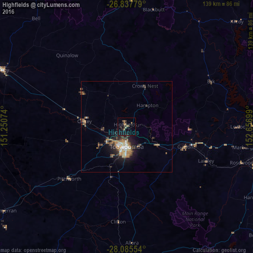
Analysis of Highfields night lights 2016
Square area 10x10 km:
 0%
0%90-99
0%80-89
0.79%70-79
0.6%60-69
4.96%50-59
0%40-49
1.79%30-39
4.56%20-29
1.79%10-19
17.26%0-9
68.25%Square area 50x50 km:
0.44%90-99
0.57%80-89
0.57%70-79
0.44%60-69
1.82%50-59
0.33%40-49
0.97%30-39
1.25%20-29
1.33%10-19
3.91%0-9
88.39%Clear (daylight) street map image can be seen on geolist.org.
Map coordinates:
26° 50' 16" South, 151° 15' 2.7" East
27° 27' 48.3" South, 151° 57' 13.9" East
28° 5' 7.9" South, 152° 39' 25.2" East
Some cities around Highfields sort by population:
• Toowoomba
10.8 km =6.7 mi,  180°
180°
• Newtown
10.5 km =6.5 mi,  191°
191°
• Harristown
13.5 km =8.4 mi, 188°
• Rangeville
13.6 km =8.5 mi,  169°
169°
• Glenvale
13.1 km =8.1 mi,  207°
207°
• East Toowoomba
12.1 km =7.5 mi, 170°
• Wilsonton
9.6 km =6 mi,  202°
202°
• South Toowoomba
12 km =7.5 mi, 183°
8219752 (p: 7,922)
Sources (retrieved 2019-11-25):
» Earth at Night: Flat Maps 2012, 2016