Fitzroy North night lights from space
Night Light of Fitzroy North (Victoria) from space (Australia) Src. Average luminocity for 10x10km area is 97.2211% and for 50x50km: 55.7553%.
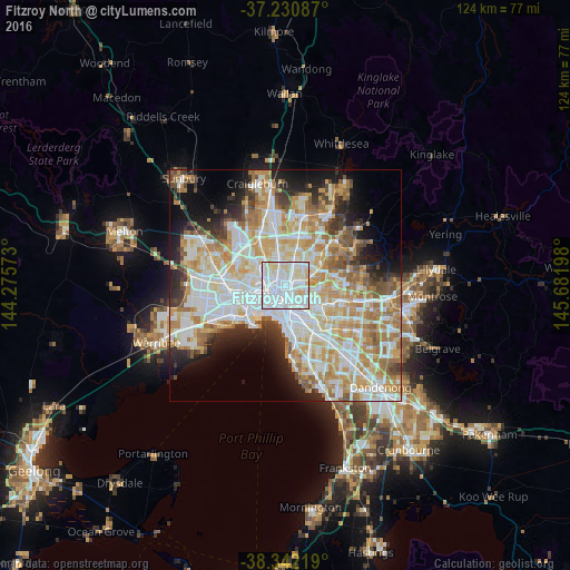
Analysis of Fitzroy North night lights 2016
Square area 10x10 km:
 61.56%
90-99
24.15%80-89
13.44%70-79
0.85%60-69
0%50-59
0%40-49
0%30-39
0%20-29
0%10-19
0%0-9
0%Square area 50x50 km:
15.25%90-99
14.09%80-89
7.06%70-79
9.7%60-69
8.07%50-59
4.73%40-49
3.68%30-39
3.48%20-29
5.88%10-19
8.24%0-9
19.83%Clear (daylight) street map image can be seen on geolist.org.
Map coordinates:
37° 13' 51.1" South, 144° 16' 32.6" East
37° 47' 19" South, 144° 58' 43.9" East
38° 20' 31.9" South, 145° 40' 55.1" East
Some cities around Fitzroy North sort by population:
• Brunswick
2.7 km =1.7 mi,  336°
336°
• Carlton
1.7 km =1.1 mi,  220°
220°
• Brunswick East
1.9 km =1.2 mi, 342°
• Parkville
2.6 km =1.6 mi,  283°
283°
• Collingwood
1.8 km =1.1 mi,  150°
150°
• Abbotsford
2.2 km =1.4 mi,  124°
124°
• Carlton North
0.8 km =0.5 mi,  273°
273°
• Clifton Hill
1.8 km =1.1 mi,  125°
125°
2154962 (p: 11,999)
Sources (retrieved 2019-11-25):
» Earth at Night: Flat Maps 2012, 2016