Essendon night lights from space
Night Light of Essendon (Victoria) from space (Australia) Src. Average luminocity for 10x10km area is 93.2959% and for 50x50km: 52.4834%.
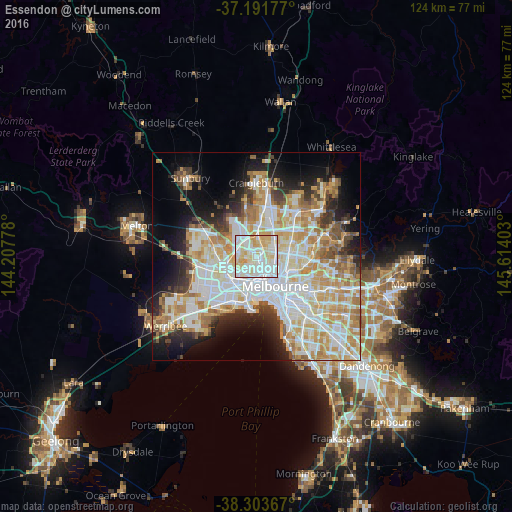
Analysis of Essendon night lights 2016
Square area 10x10 km:
 37.59%
90-99
30.44%80-89
21.26%70-79
10.54%60-69
0.17%50-59
0%40-49
0%30-39
0%20-29
0%10-19
0%0-9
0%Square area 50x50 km:
14.39%90-99
13.04%80-89
6.79%70-79
8.96%60-69
6.7%50-59
4.13%40-49
3.59%30-39
3.61%20-29
6.21%10-19
9.59%0-9
22.99%Clear (daylight) street map image can be seen on geolist.org.
Map coordinates:
37° 11' 30.4" South, 144° 12' 28" East
37° 44' 59.3" South, 144° 54' 39.2" East
38° 18' 13.2" South, 145° 36' 50.5" East
Some cities around Essendon sort by population:
• Pascoe Vale
2.7 km =1.7 mi,  47°
47°
• Ascot Vale
3.5 km =2.2 mi,  162°
162°
• Moonee Ponds
1.9 km =1.2 mi, 164°
• Brunswick West
3.3 km =2.1 mi,  119°
119°
• Maribyrnong
3.4 km =2.1 mi,  222°
222°
• Pascoe Vale South
3.3 km =2.1 mi,  70°
70°
• Strathmore
1.8 km =1.1 mi,  28°
28°
• Niddrie
2.1 km =1.3 mi,  309°
309°
2167208 (p: 20,310)
Sources (retrieved 2019-11-25):
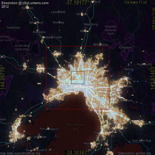
» Earth at Night: Flat Maps 2012, 2016