Derrimut night lights from space
Night Light of Derrimut (Victoria) from space (Australia) Src. Average luminocity for 10x10km area is 84.6463% and for 50x50km: 39.2655%.
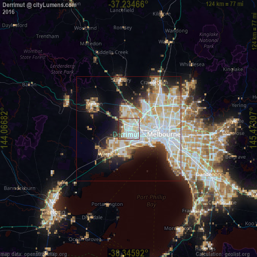
Analysis of Derrimut night lights 2016
Square area 10x10 km:
 38.1%
38.1%90-99
27.04%80-89
9.01%70-79
3.91%60-69
4.76%50-59
2.89%40-49
5.44%30-39
6.46%20-29
2.38%10-19
0%0-9
0%Square area 50x50 km:
11.85%90-99
9.59%80-89
4.67%70-79
5.37%60-69
4.28%50-59
3.17%40-49
2.62%30-39
2.85%20-29
5.28%10-19
9.9%0-9
40.42%Clear (daylight) street map image can be seen on geolist.org.
Map coordinates:
37° 14' 4.8" South, 144° 4' 0.6" East
37° 47' 32.6" South, 144° 46' 11.8" East
38° 20' 45.3" South, 145° 28' 23.1" East
Some cities around Derrimut sort by population:
• St Albans
5.9 km =3.7 mi,  26°
26°
• Truganina
3.2 km =2 mi,  212°
212°
• Sunshine West
4.1 km =2.5 mi,  88°
88°
• Deer Park
2.8 km =1.7 mi,  353°
353°
• Sunshine North
5.7 km =3.5 mi,  63°
63°
• Cairnlea
4 km =2.5 mi,  23°
23°
• Sunshine
5.7 km =3.5 mi,  79°
79°
• Albanvale
5.1 km =3.2 mi,  358°
358°
2169018 (p: 8,200)
Sources (retrieved 2019-11-25):
» Earth at Night: Flat Maps 2012, 2016