Calwell night lights from space
Night Light of Calwell (ACT) from space (Australia) Src. Average luminocity for 10x10km area is 48.8736% and for 50x50km: 13.0027%.
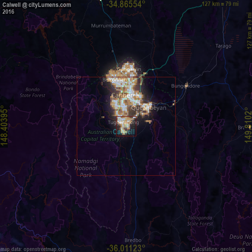
Analysis of Calwell night lights 2016
Square area 10x10 km:
 6.41%
6.41%90-99
9.89%80-89
7.69%70-79
10.44%60-69
11.17%50-59
3.48%40-49
3.3%30-39
4.21%20-29
12.27%10-19
22.89%0-9
8.24%Square area 50x50 km:
2.22%90-99
2.66%80-89
1.16%70-79
1.87%60-69
3.04%50-59
1.48%40-49
1.19%30-39
2.23%20-29
2.68%10-19
5.11%0-9
76.35%Clear (daylight) street map image can be seen on geolist.org.
Map coordinates:
34° 51' 55.9" South, 148° 24' 14.2" East
35° 26' 25.5" South, 149° 6' 25.5" East
36° 0' 40.4" South, 149° 48' 36.7" East
Some cities around Calwell sort by population:
• Kambah
7.5 km =4.7 mi,  323°
323°
• Jerrabomberra
10.7 km =6.6 mi,  54°
54°
• Gordon
2.7 km =1.7 mi,  227°
227°
• Wanniassa
5 km =3.1 mi,  342°
342°
• Narrabundah
12.3 km =7.6 mi,  18°
18°
• Monash
3.1 km =1.9 mi,  331°
331°
• Curtin
13.1 km =8.1 mi,  348°
348°
• Chisholm
3.7 km =2.3 mi,  31°
31°
8347865 (p: 5,600)
Sources (retrieved 2019-11-25):
» Earth at Night: Flat Maps 2012, 2016