Belmont night lights from space
Night Light of Belmont (Western Australia) from space (Australia) Src. Average luminocity for 10x10km area is 95.7063% and for 50x50km: 42.923%.
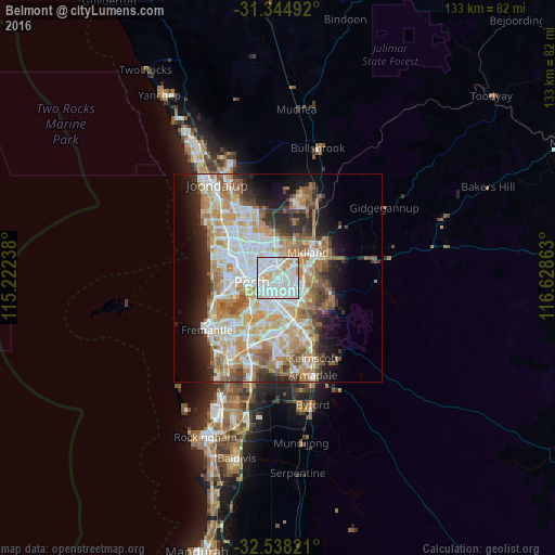
Analysis of Belmont night lights 2016
Square area 10x10 km:
 43.53%
90-99
40.56%80-89
9.62%70-79
5.24%60-69
1.05%50-59
0%40-49
0%30-39
0%20-29
0%10-19
0%0-9
0%Square area 50x50 km:
9.64%90-99
10.5%80-89
5.01%70-79
6.65%60-69
8.28%50-59
4.86%40-49
3.1%30-39
3.4%20-29
6.5%10-19
8.32%0-9
33.74%Clear (daylight) street map image can be seen on geolist.org.
Map coordinates:
31° 20' 41.7" South, 115° 13' 20.6" East
31° 56' 36.6" South, 115° 55' 31.8" East
32° 32' 17.6" South, 116° 37' 43.1" East
Some cities around Belmont sort by population:
• Bayswater
3.1 km =1.9 mi,  346°
346°
• Maylands
3.2 km =2 mi,  295°
295°
• Rivervale
1.8 km =1.1 mi,  221°
221°
• Bassendean
4.2 km =2.6 mi,  24°
24°
• Victoria Park
4.1 km =2.5 mi,  207°
207°
• Cloverdale
2.8 km =1.7 mi,  140°
140°
• Kewdale
4.6 km =2.9 mi,  147°
147°
• Carlisle
4.1 km =2.5 mi,  189°
189°
8299578 (p: 6,799)
Sources (retrieved 2019-11-25):
» Earth at Night: Flat Maps 2012, 2016