Linz night lights from space
Night Light of Linz (Upper Austria) from space (Austria) Src. Average luminocity for 10x10km area is 52.723% and for 50x50km: 7.7551%.
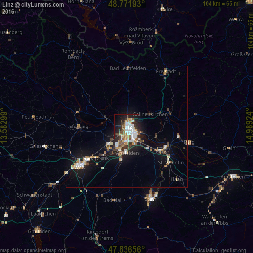

Analysis of Linz night lights 2016
Square area 10x10 km:
 14.35%
90-99
13.92%80-89
5.54%70-79
4.4%60-69
5.26%50-59
3.98%40-49
5.4%30-39
7.1%20-29
13.21%10-19
19.03%0-9
7.81%Square area 50x50 km:
1.14%90-99
1.42%80-89
0.71%70-79
0.78%60-69
0.74%50-59
0.98%40-49
1.12%30-39
1.1%20-29
1.82%10-19
6%0-9
84.18%Clear (daylight) street map image can be seen on geolist.org.
Map coordinates:
48° 46' 18.9" North, 13° 34' 58.8" East
48° 18' 23" North, 14° 17' 10" East
47° 50' 11.6" North, 14° 59' 21.3" East
Some cities around Linz sort by population:
• Traun
10.1 km =6.3 mi,  200°
200°
• Enns
17.5 km =10.9 mi,  126°
126°
• Marchtrenk
18.4 km =11.4 mi,  225°
225°
• Haid
11.6 km =7.2 mi,  192°
192°
• Sankt Martin
8.5 km =5.3 mi, 189°
• Gallneukirchen
10.9 km =6.8 mi,  61°
61°
• Hart
5.1 km =3.2 mi,  205°
205°
• Haag
4.2 km =2.6 mi, 197°
2772400 (p: 204,846)
Sources (retrieved 2019-11-25):
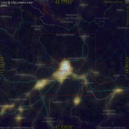
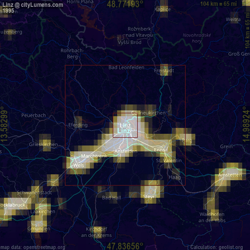
» NASA, Earths city lights 1995
» NASA city lights 2003
» Earth at Night: Flat Maps 2012, 2016