Hart night lights from space
Night Light of Hart (Upper Austria) from space (Austria) Src. Average luminocity for 10x10km area is 53.8824% and for 50x50km: 8.1488%.
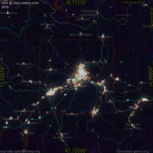
Analysis of Hart night lights 2016
Square area 10x10 km:
 11.01%
90-99
13.39%80-89
6.99%70-79
4.17%60-69
6.1%50-59
7.29%40-49
9.67%30-39
8.63%20-29
14.43%10-19
13.1%0-9
5.21%Square area 50x50 km:
1.2%90-99
1.48%80-89
0.77%70-79
0.82%60-69
0.82%50-59
1.01%40-49
1.25%30-39
1.15%20-29
1.76%10-19
6.04%0-9
83.68%Clear (daylight) street map image can be seen on geolist.org.
Map coordinates:
48° 43' 52.2" North, 13° 33' 13.6" East
48° 15' 54.9" North, 14° 15' 24.9" East
47° 47' 42.2" North, 14° 57' 36.1" East
Some cities around Hart sort by population:
• Linz
5.1 km =3.2 mi,  25°
25°
• Traun
5.1 km =3.2 mi,  195°
195°
• Marchtrenk
13.8 km =8.6 mi,  232°
232°
• Haid
6.7 km =4.2 mi,  183°
183°
• Sankt Martin
3.9 km =2.4 mi,  168°
168°
• Gallneukirchen
15.3 km =9.5 mi,  50°
50°
• Neuhofen an der Krems
14.2 km =8.8 mi,  188°
188°
• Haag
1.1 km =0.7 mi,  55°
55°
2776815 (p: 5,610)
Sources (retrieved 2019-11-25):
» Earth at Night: Flat Maps 2012, 2016