Lind night lights from space
Night Light of Lind (Carinthia) from space (Austria) Src. Average luminocity for 10x10km area is 21.1378% and for 50x50km: 2.2374%.
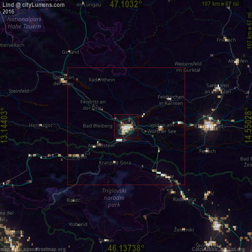
Analysis of Lind night lights 2016
Square area 10x10 km:
 2.27%
2.27%90-99
3.27%80-89
2.41%70-79
3.55%60-69
1.99%50-59
0.71%40-49
4.55%30-39
3.41%20-29
1.85%10-19
24.43%0-9
51.56%Square area 50x50 km:
0.22%90-99
0.46%80-89
0.25%70-79
0.27%60-69
0.14%50-59
0.28%40-49
0.42%30-39
0.29%20-29
0.32%10-19
1.21%0-9
96.16%Clear (daylight) street map image can be seen on geolist.org.
Map coordinates:
47° 6' 11.5" North, 13° 8' 38.5" East
46° 37' 20.8" North, 13° 50' 49.7" East
46° 8' 14.6" North, 14° 33' 1" East
Some cities around Lind sort by population:
• Villach
1.5 km =0.9 mi,  153°
153°
• Jesenice, SI
27.2 km =16.9 mi,  141°
141°
• Finkenstein am Faaker See
8.3 km =5.2 mi,  125°
125°
• Villach-Innere Stadt
1.1 km =0.7 mi,  183°
183°
• Auen
2.5 km =1.6 mi,  185°
185°
• Völkendorf
2 km =1.2 mi,  216°
216°
• Wölfnitz
31.7 km =19.7 mi,  81°
81°
• Kranjska Gora, SI
19.1 km =11.9 mi,  195°
195°
11746590 (p: 5,252)
Sources (retrieved 2019-11-25):
» Earth at Night: Flat Maps 2012, 2016