Leoben night lights from space
Night Light of Leoben (Styria) from space (Austria) Src. Average luminocity for 10x10km area is 14.369% and for 50x50km: 2.0892%.
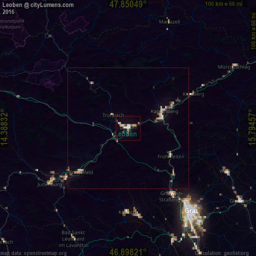
Analysis of Leoben night lights 2016
Square area 10x10 km:
 2.38%
2.38%90-99
3.27%80-89
0.45%70-79
1.34%60-69
2.68%50-59
0.6%40-49
1.64%30-39
0.74%20-29
3.13%10-19
3.13%0-9
80.65%Square area 50x50 km:
0.23%90-99
0.3%80-89
0.23%70-79
0.18%60-69
0.25%50-59
0.16%40-49
0.38%30-39
0.37%20-29
0.37%10-19
0.64%0-9
96.88%Clear (daylight) street map image can be seen on geolist.org.
Map coordinates:
47° 51' 1.8" North, 14° 23' 18" East
47° 22' 35.4" North, 15° 5' 29.2" East
46° 53' 53.6" North, 15° 47' 40.5" East
Some cities around Leoben sort by population:
• Knittelfeld
27.3 km =17 mi,  229°
229°
• Bruck an der Mur
15.1 km =9.4 mi,  72°
72°
• Trofaiach
8.4 km =5.2 mi,  310°
310°
• Gratkorn
33.3 km =20.7 mi,  144°
144°
• Hafendorf
19.3 km =12 mi,  62°
62°
• Deuchendorf
20 km =12.4 mi, 60°
• Judendorf
2.7 km =1.7 mi,  13°
13°
• Kindberg
30.3 km =18.8 mi, 63°
2772649 (p: 8,264)
Sources (retrieved 2019-11-25):
» Earth at Night: Flat Maps 2012, 2016