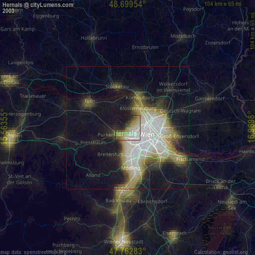
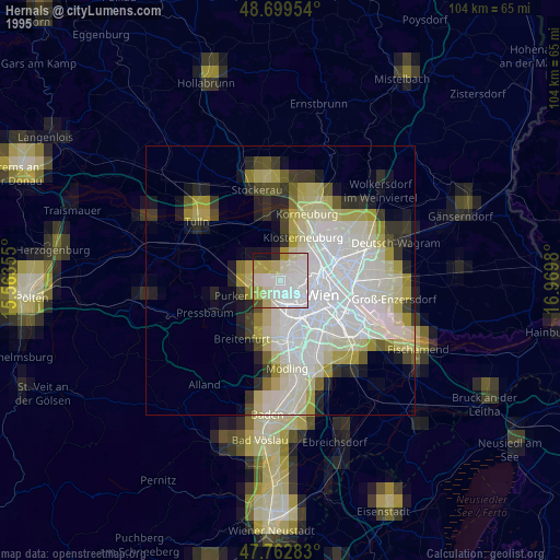
Hernals night lights from space
Night Light of Hernals (Vienna) from space (Austria) Src. Average luminocity for 10x10km area is 47.0759% and for 50x50km: 24.3183%.
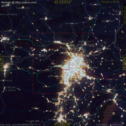
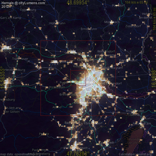
Analysis of Hernals night lights 2016
Square area 10x10 km:
 14.43%
90-99
8.78%80-89
3.57%70-79
6.85%60-69
3.87%50-59
5.95%40-49
4.17%30-39
7.14%20-29
11.46%10-19
16.82%0-9
16.96%Square area 50x50 km:
6.35%90-99
5.21%80-89
2%70-79
2.55%60-69
2.75%50-59
2.46%40-49
2.43%30-39
3.1%20-29
6.21%10-19
9.88%0-9
57.06%Clear (daylight) street map image can be seen on geolist.org.
Map coordinates:
48° 41' 58.3" North, 15° 33' 48.8" East
48° 13' 60" North, 16° 16' 0" East
47° 45' 46.2" North, 16° 58' 11.3" East
Some cities around Hernals sort by population:
• Vienna
8.3 km =5.2 mi,  109°
109°
• Floridsdorf
10 km =6.2 mi,  79°
79°
• Ottakring
3.1 km =1.9 mi,  126°
126°
• Meidling
8.9 km =5.5 mi,  146°
146°
• Hietzing
5.7 km =3.5 mi,  157°
157°
• Innere Stadt
8.2 km =5.1 mi, 109°
• Klosterneuburg
9.1 km =5.7 mi,  28°
28°
• Purkersdorf
7.3 km =4.5 mi,  247°
247°
2776488 (p: 57,546)
Sources (retrieved 2019-11-25):
» NASA, Earths city lights 1995
» NASA city lights 2003
» Earth at Night: Flat Maps 2012, 2016