Rosario night lights from space
Night Light of Rosario (Santa Fe) from space (Argentina) Src. Average luminocity for 10x10km area is 68.5952% and for 50x50km: 23.9979%.
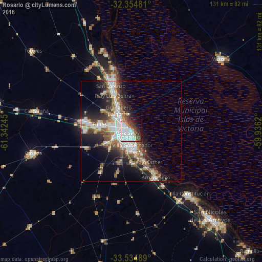

Analysis of Rosario night lights 2016
Square area 10x10 km:
 35.35%
90-99
15.57%80-89
0.18%70-79
0.73%60-69
5.86%50-59
6.41%40-49
9.16%30-39
8.06%20-29
7.33%10-19
8.79%0-9
2.56%Square area 50x50 km:
5.51%90-99
4.83%80-89
1.91%70-79
2.41%60-69
3.1%50-59
3.37%40-49
3.62%30-39
3.99%20-29
5.8%10-19
9.89%0-9
55.59%Clear (daylight) street map image can be seen on geolist.org.
Map coordinates:
32° 21' 17.3" South, 61° 20' 32.8" West
32° 56' 48.6" South, 60° 38' 21.6" West
33° 32' 5.6" South, 59° 56' 10.3" West
Some cities around Rosario sort by population:
• Gobernador Gálvez
9.3 km =5.8 mi,  180°
180°
• Granadero Baigorria
12.4 km =7.7 mi,  323°
323°
• Capitán Bermúdez
15.7 km =9.8 mi,  331°
331°
• Pérez
13.3 km =8.3 mi,  244°
244°
• Arroyo Seco
26.1 km =16.2 mi,  152°
152°
• Funes
16.3 km =10.1 mi,  282°
282°
• Fray Luis A. Beltrán
19.2 km =11.9 mi, 334°
• Roldán
25.5 km =15.8 mi, 282°
3838583 (p: 1,173,533)
Sources (retrieved 2019-11-25):
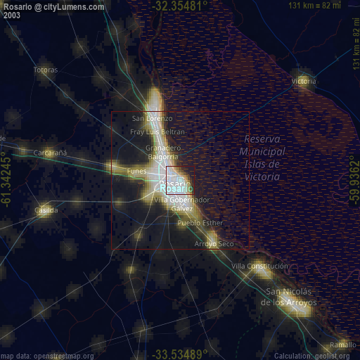
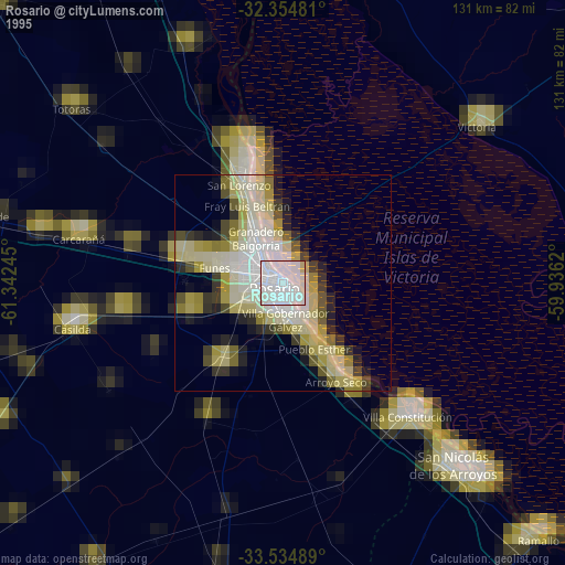
» NASA, Earths city lights 1995
» NASA city lights 2003
» Earth at Night: Flat Maps 2012, 2016